This forecast displays data for both the Jackson Hole Valley & the Teton Mountains. The NWS National Blended Model (NBM) is utilized as the base, MountainWeather™ then adds value to this by infusing over 30-years of local forecasting experience.
Jackson Hole Weather News
Some Jackson Hole weather history, records, and interesting weather facts…
No records broken in Jackson with weekend’s heat wave
- Friday, July 10th: Forecast high temperature was 89°F. Official high temperature in Jackson was 84°F. Record high for that date is 92°F, in 2003.
- Saturday, July 11th: Forecast high temperature was 94°F. Official high temperature in Jackson was 88°F. Record high for that date also 92°F, in 2003.
- Sunday, July 12th: Forecast high temperature was 100°F. Official high temperature in Jackson was 92°F. Record high for that date is 96°F, in 1934.
- Monday, July 13th: Forecast high temperature was 98°F. Official high temperature in Jackson was 91°F. Record high for that date is 98°F, in 1934.
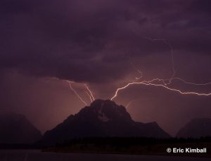
Click for the latest MountainWeather Blog: Lightning Safety >>

National Digital Forecast Database
Jackson Hole and Teton Mountain Range
Forecast Powered by MountainWeather™ & NWS
Issued on:
Tuesday, July 14, 2026

Sunny then Scattered T-storms
Mountains @10,000ft
TEMP
WIND N
Today:
Tonight:

A 40 percent chance of showers and thunderstorms after 3pm. Mostly sunny, with a high near 91. Calm wind becoming west around 6 mph in the afternoon.
A 30 percent chance of showers and thunderstorms before midnight. Partly cloudy, with a low around 54. North wind around 5 mph becoming calm in the evening.
A 40 percent chance of showers and thunderstorms after noon. Mostly sunny, with a high near 91. Calm wind becoming west northwest around 5 mph in the afternoon.
A 40 percent chance of showers and thunderstorms before midnight. Partly cloudy, with a low around 53. Southeast wind around 5 mph becoming calm after midnight.
A 40 percent chance of showers and thunderstorms after noon. Mostly sunny, with a high near 92. Calm wind becoming southwest around 5 mph in the afternoon.
A 30 percent chance of showers and thunderstorms before midnight. Partly cloudy, with a low around 54.

A 40 percent chance of showers and thunderstorms after noon. Sunny, with a high near 89.
A 20 percent chance of showers and thunderstorms before midnight. Partly cloudy, with a low around 54.
5-Day Forecast Graphs
Click for a Printable Version of the JH Forecast >>
Click to read the Riverton NWS Forecast Discussion >>
Click to read the Pocatello NWS Forecast Discussion >>
JH Almanac Info
Today
Sunset: 8:59pm
Sunset: 8:59pm
Sunset: 8:58pm
Sunset: 8:57pm
Sunset: 8:56pm
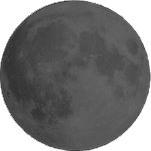
New Moon
Current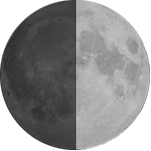
First Qtr.
Jul 21st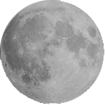
Full Moon
Jul 28th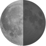
Last Qtr.
Aug 5thThis Week’s...
Average Hi: 82°F
on July 14, 1977
on July 17, 1934
NWS Forecasts & Reports
Jackson Hole WAM
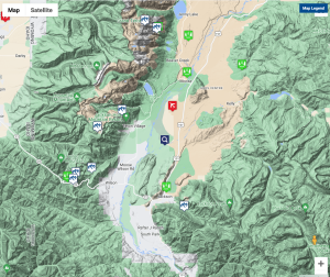
How to Use this Map
- This map can be used to access Current Weather conditions AND Point Forecasts for each specific location.
- Current Weather observations are in 2 formats. …NWS & MesoWest.
- NWS Point Forecasts have 3 formats to choose from.
- Chose the NWS Graph button for the most detailed forecast info: hour by hour temps, winds, windchill, cloud cover, precip & snowfall amounts, and lightning activity forecasts.
- Use the Magnifying Glass icon to get a forecast for any location. It will stay in the center of the map as you move the map around. Zoom-in for a more precise location.
NWS Forecast Links
![]()
JH Tram @10,000-ft.
Tetons @11,600-ft.
Discussions
Local JH Reports
Other Reports
Ski Reports
Click for Current Weather Conditions & Local Webcams >>