After a nice warm and dry start to the normally wet and cool month of May, we are back to a cool and showery weather pattern for the Memorial Day Weekend in the Rockies.
At least through Sunday, rain or snow showers are to be expected each day here in Jackson Hole, with highs only getting into the 50’s the rest of this week. That’s kind of hard to take after already experiencing several days earlier in May that were up into the 70’s, and one day tagging 80 degrees!
By Monday, Memorial Day, we should be back to sunnier skies and temps warming back up above 60 degrees, and maybe edging back up around 70 by mid-week.
What lies ahead for this Summer?
What I hear on the street is that we are in for a “hot and dry” summer. A look at the Farmer’s Almanac backs that prognostication up, as well. But I usually defer to the Climate Prediction Center (CPC), to see how the next few months are expected to shake out, at least in general.
The CPC is a branch of the National Weather Service or NOAA whose sole task is to analyze the weather out beyond the standard 3 to 7-day forecast, as it relates to temperatures and precipitation being above or below “normal”, over the long term.
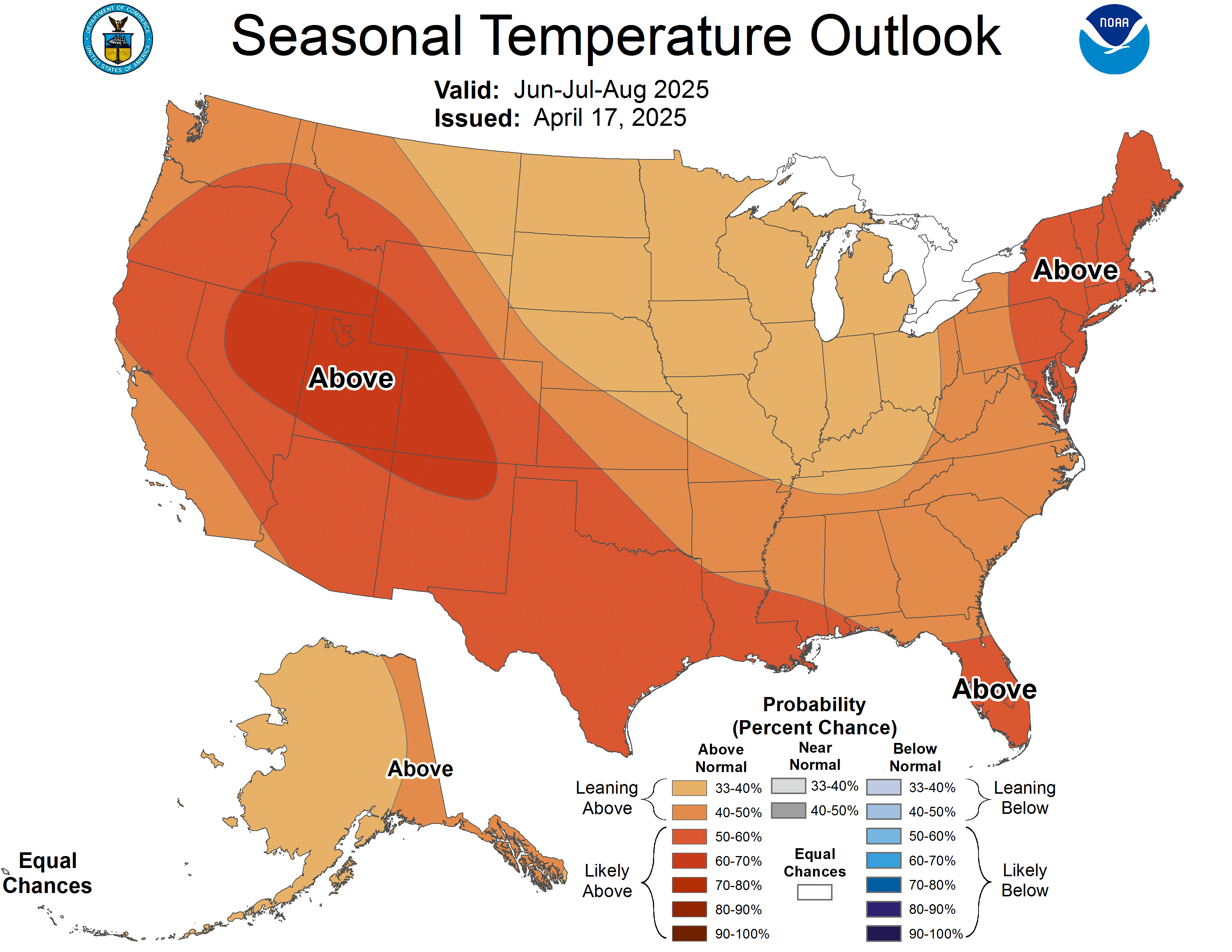
These are the maps you see below, for June-July-August. The 3-Month Temperature Outlook for the Southwestern U.S., especially, is solidly in the “above” normal category. Most of the rest of the southern tier of the U.S. is expected to be warmer than normal, as is the northern Rockies, including Idaho & Wyoming.
|
|
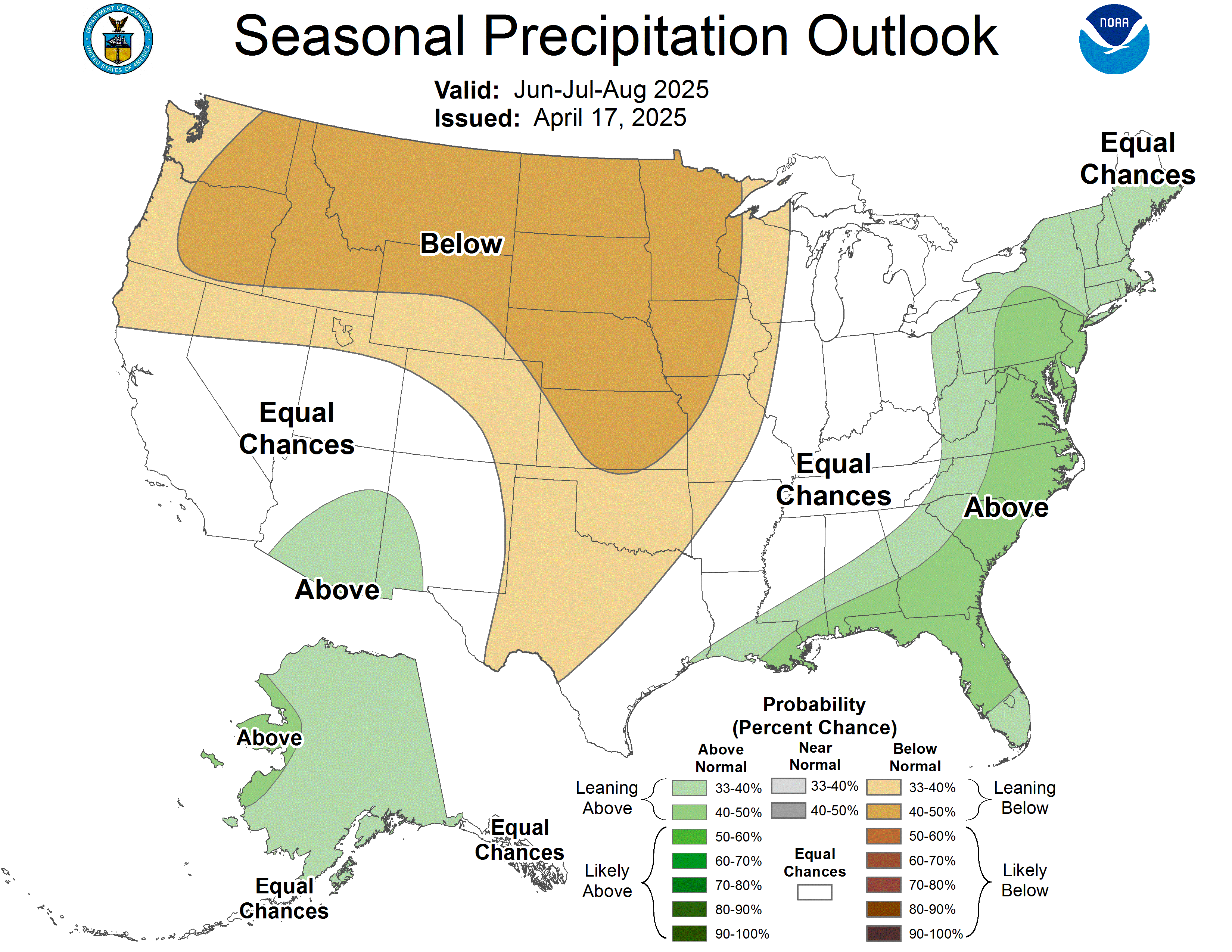
However, the only area of the country that has a high probability of seeing “below” normal precipitation is northern Idaho and western Montana. Southern Idaho and Northwestern Wyoming fall under a lesser probability category, and everywhere else in the country (with the exception of southern Florida), has an “Equal Chance” (EC) of being either above or below normal, or just normal.
For a little more insight into how the CPC determines all of this, go to this link:
You will see just how much data and how many different climate indicators these guys consider when putting these simple maps together. More than meets the eye!
One of the factors the CPC considers is the current ENSO (El Nino Southern Oscillation) or El Nino/La Nina situation in the equatorial Pacific, which is currently in a Neutral phase, by the way.
To follow the long range outlooks throughout the year and to hunt down more info about La Nina and El Nino you can go through the NWS Discussions & Outlooks page on mountainweather.com, direct link is here:
What’s My Take?
In the short term, the early part of June looks slightly cooler and more showery for Jackson Hole, beyond that, we’ll really have to wait and see as the summer goes on.
I do expect since the snow at low elevations has been gone awhile now, that the ground will heat up more readily and warmer than normal temps this summer would be likely. But it only takes one or two good thunderstorms a month to bring us our normal, or even above normal, precipitation amounts. The problem with that is, that more thunderstorms could potentially lead to more forest fires.
Text submitted by meteorologist Jim Woodmencey
Graphics from NWS


