 |
| Meteorologist Jim Woodmencey |
The weather we had this past Saturday morning caught me a little by surprise, with a line of thunderstorms moving over NW Wyoming and directly over the Grand Teton at around 8:30 a.m.
I was actually expecting that kind of weather Friday morning, not Saturday. When it didn’t materialize, I thought, “oh well, it must have dissipated or not be as moist and unstable as I thought”.
The reality was, that moist and unstable air, what looked on Thursday to be an almost “monsoon-like” surge moving up from Arizona, didn’t make it to us until early Saturday morning. That is a lot of time to be “off” by.
This very small surge of moisture that originated down in Arizona on Thursday, and was evident way down there on satellite and radar, and lightning maps, and then it crept its way north thru Utah with very little fanfare.
As with a normal surge from the monsoon, thunderstorms are possible anytime of day or night and they don’t need the afternoon heating to get them going. This case was eerily similar in nature. The only other indicator for the possibility of seeing earlier-in-the-day type thunderstorms was the presence of a stationary front in NE Idaho & NW Wyoming. I generally discounted that because it had been there the previous two days and did not seem to lend any additional boost to thunderstorm development on Thursday, or even on Friday. We had no thunderstorms here Thursday of last week, and only a few isolated strikes around the region Friday.
Re-Analysis
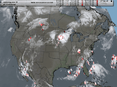
A series of maps (satellite, radar, & lightning maps) that I saved from this event illustrates how innocuous it looked and how quickly this developed. There were no lightning strikes evident over northern Utah or eastern Idaho prior to about 6:00 am, after that, things developed very fast that morning.
There was little to no indication on the computer models I looked at on Friday morning, after analyzing dozens of different products to give me an indication of moisture and instability. I had the thunderstorm potential at zero in the am Saturday, 60% in the pm for Saturday on my forecast that I issued on Friday morning.
I checked the NWS forecast at 8:00 am and it said “Slight Chance of Thunderstorms”. And once the lightning started, they issued a thunderstorm warning. So, apparently the NWS saw no early indicators either.
A bad forecast from my end, as I see it. And that’s why I re-analyzed that morning. My conclusion was, that it was one of those smaller features that would easily slip thru the cracks in the model resolution that was not picked up. Especially 24 hours ahead of time when I made my last forecast on Friday morning. But the rub is, there was little or no sign of developing activity overnight as that airmass moved up thru Utah, and then once it got over SE Idaho, and maybe got better orographics or closer to that stationary front, it really kicked in.
I don’t like to miss stuff or be wrong about the weather, I take that personally, especially when it coincides with outdoor activities in Jackson Hole on a Saturday morning! However, that is also one of the things that I love about this game of weather forecasting, even with all the latest technology and sophisticated computer models, we still can’t see it all………and Mother Nature always gets to bat last!
Post by Meteorologist Jim Woodmencey
Graphics From NWS & MeteoStar-LEADS On-line
Maps from around 6:00 – 7:30 AM Saturday
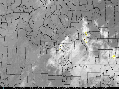 |
| Satellite 7:00 am MST |
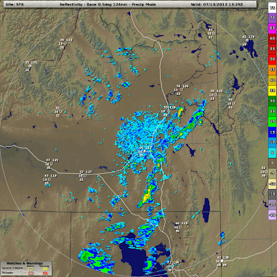 |
| Radar 7:30 am MST |
 |
||||||||
| Lightning Strike Map 6:15 am MST |
Maps from around 8:00 – 8:30 AM Saturday
 |
|
| Satellite 8:00 am MST |
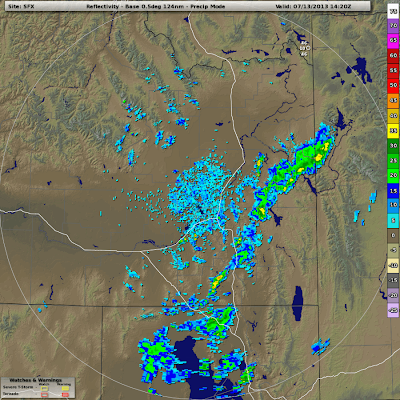 |
| Radar 8:20 am MST |
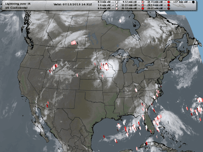 |
| Lightning Strike Map 8:30 am MST |
Photos from Saturday Morning
 |
| Looking South from near Moose, WY Photos by Rick Paul |


