 |
| Meteorologist Jim Woodmencey |
Nice dump of snow for Jackson last night, with about 5 inches in a couple of hours at my house near Snow King Mountain. At 7:00 pm there was no snow, by 9:00 pm I was shoveling the deck. As I write this at 5:00 a.m. on Tuesday morning, there is another 4 or 5 inches on the deck. Total of 8 to 10 inches in less than 12 hours. (It is still October, isn’t it?)
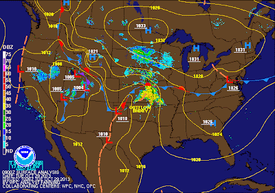
This snowstorm was courtesy of a slow moving and very large Low pressure system that moved into the Western U.S. on Sunday. It basically parked itself over the Great Basin Monday and wrapped some cold air from Canada into itself.
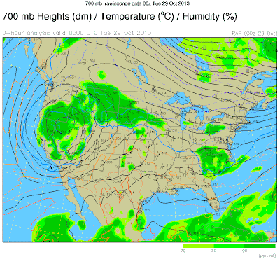
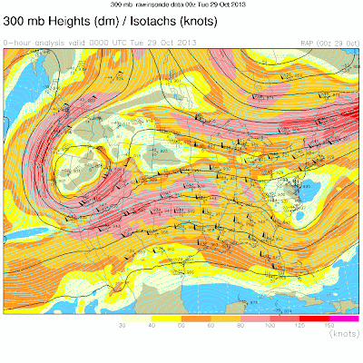
For the most part, the flow aloft was out of the South overnight, a flow which favors Snow King Mountain and the Town of Jackson for orographic snowfall, that is, the extra lift the mountains provide to boost the snowfall. The jet stream was also in an optimal position to give an extra boost, as well.
Looking around at other mountain instruments, it seems that 6 to 8 inches overnight was the norm, even up at elevation in the Tetons. So a fairly even distribution from what we received in Town and what fell at 8 to 10,000-ft. in the Teton Range.
After a week of High pressure and sunny weather last week, we switched gears pretty quickly on Monday.
Even though technically I a supposed to be on my “Fall Break” right now, I couldn’t resist looking at this storm. Now our 5th snowstorm in the Tetons since late September.
I am off to Alaska this coming week to teach a weather course. Back to forecasting for JH on Nov. 11th.
 |
| Surface Map |
 |
| 700mb Map (around 10,000-ft. elevation) |
 |
| Jet Stream Map (@ 30,000-ft.) |
Post by Jim Woodmencey
Graphics from NOAA

