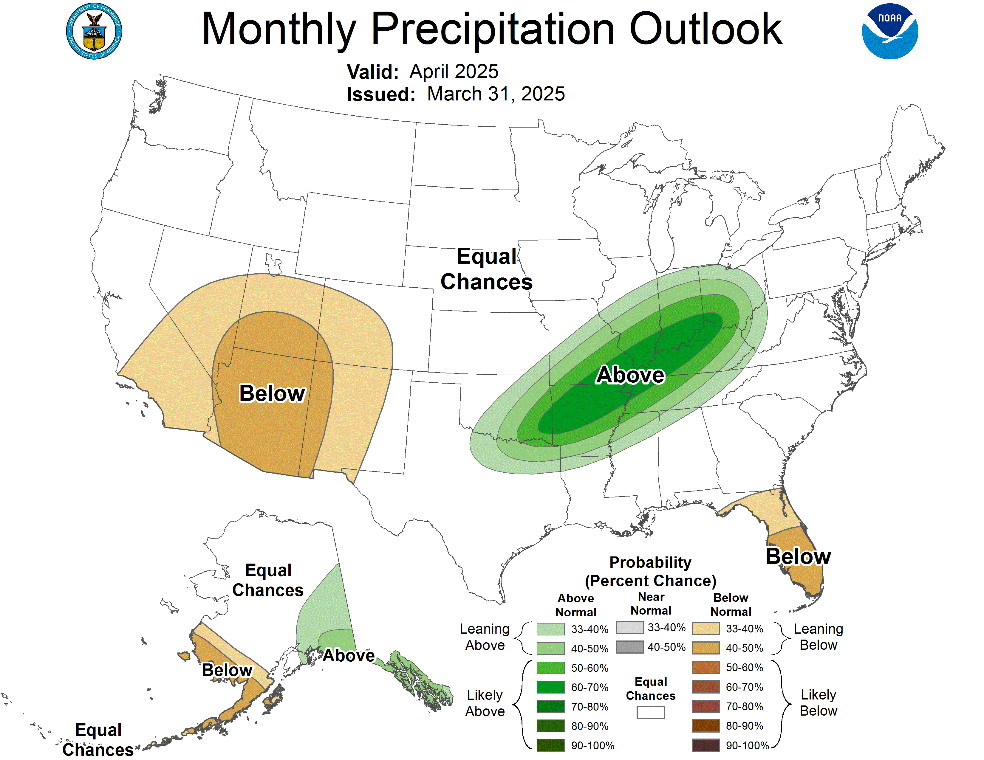
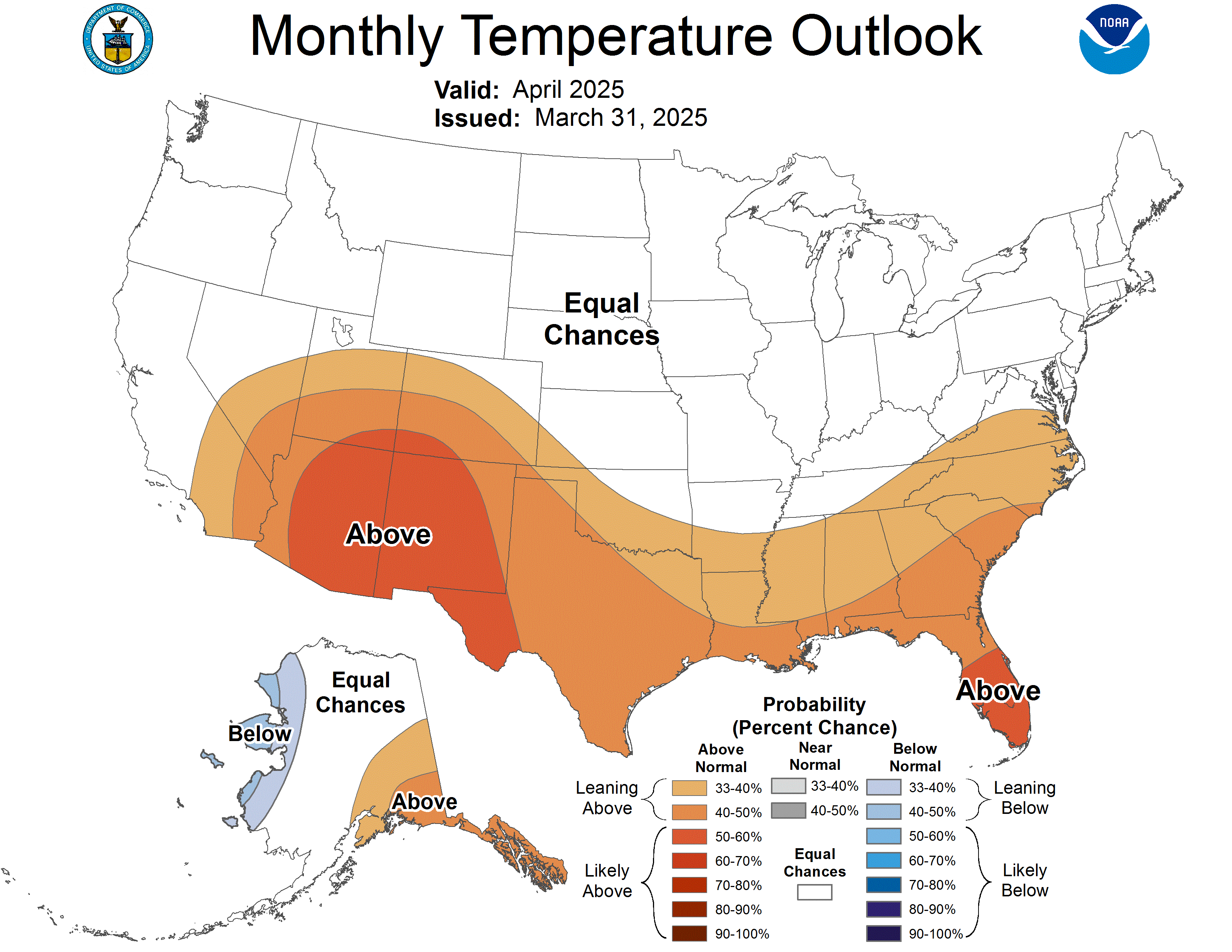
A word from meteorologist Jim Woodmencey on the August Outlook Maps:
As it might relate to the Eclipse date of August 21st… The outlook for the month of August, as a whole is for warmer than normal temperatures along the entire path of the Eclipse, across the U.S.A. From Oregon to Wyoming, warmer than normal temps usually coincides with High-pressure & drier weather. However, the line for a 50% probability of having above normal precipitation edges into Southeast Idaho, Southwestern & South-central Wyoming. The “bulls-eye” of above normal precipitation over the Four–Corners Region, which is well south of the path of totality, is indicative of an active monsoon season ( i.e. more clouds & thunderstorms). Monsoon moisture will periodically push further north over Idaho & Wyoming, as it did in the latter half of July.


How to Read the Outlook Maps from the National Weather Service:
The contours on the map show the total probability (%) of two categories, above, indicated by the letter “A”, and below, indicated by the letter “B”. At any point on the map, the sum of the probabilities of these two categories is 100%.
For any particular location, and season, these two categories are defined from the 30 observations from 1981-2010. The coldest or driest 1/2 (15 years) define the B category, the warmest or wettest 1/2 (15 years) defines the A category.
When the forecasters decide that one of the extreme categories, say above (A), is the most likely one, they assign probabilities which exceed 50% to that category. This means that the chance of the opposite category is the remaining part of the total (100%). In regions where the forecasters have no indications favoring either A, or B, the chance of these two categories is defined to be 50% each, and the region is labeled “EC”, which stands for equal chances.

