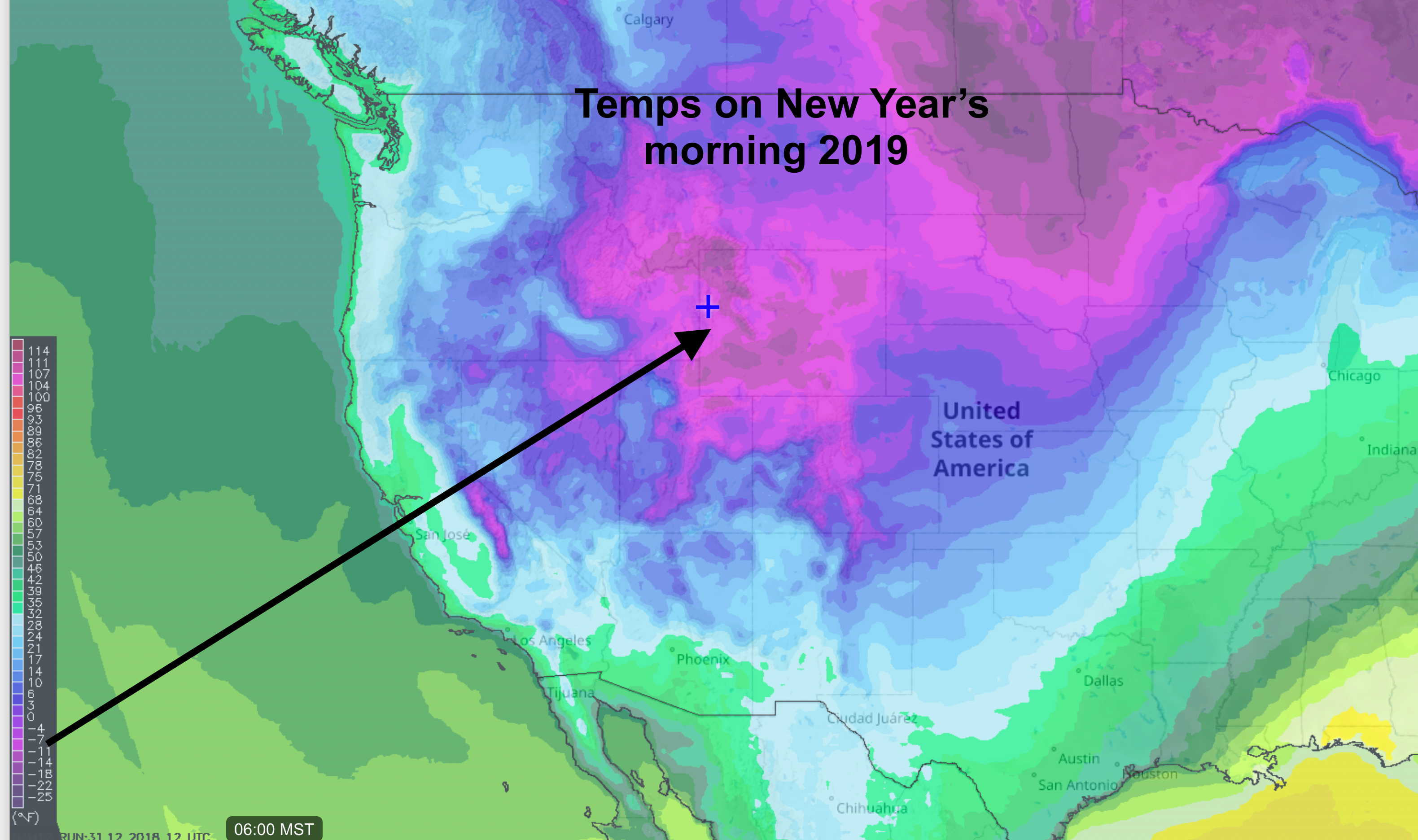
A good portion of the Rockies and Plains States will be waking up to start the New year with some very cold temperatures. A cold Trof of Low pressure at all elevations in the atmosphere has moved south from Canada in a Northerly flow.
Below is a temperature forecast map for 6:00 AM (Mountain Time) on New Year’s Day. Pink & purple colors represents temps below zero Fahrenheit.
Jackson Hole, WY looks to drop into the teens below zero. Some areas may reach 20-below. BUT! That will depend on cloud cover and wind. Some clouds &/or some wind overnight will keep temps warmer than forecast. No wind & no clouds and it will reach 20-below.
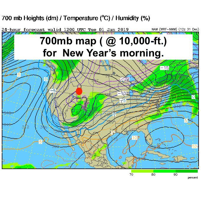
Cold Up High
Temps are not any warmer up at elevation this last day of 2018, but thankfully they will be warming up the first few days of 2019, with temperature inversions setting up.
It will get warmer up high as it gets colder down low. So, if you are skiing Jackson Hole this New Year’s week, “go up to warm up!”
Forecast map below for the 700mb level in the atmosphere, or near the 10,000-ft. Elevation. Temps in Celsius, 15 below zero C equals +5 degrees F. So, it could be 20 degrees warmer up high on New Year’s Day in the mountains. (Jackon Hole marked with red dot).
Cold & Windy Last Day of 2018
What Jackson Hole woke up to this morning was very cold air and strong northerly winds. Winds in the valley were over 20 mph and winds on top of the tram were over 40 mph. That made for some brutal wind chills, in the minus 30-degree range at times up at 10,000-ft in the Tetons.
Below are the Temperature and Wind graphs for the past 24-hours (Sunday AM to Monday AM) and a wind chill chart for reference. (Click to expand and print!)
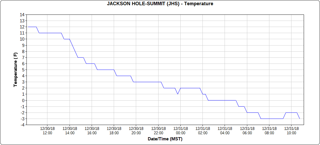
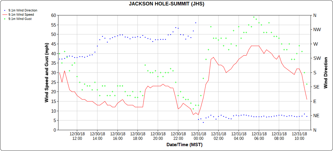
Around 6:00 AM Monday morning the temp at the top of the tram was -2F, with a wind speed of 44 mph, making it feel like it was 33 below zero!
Happy New Year! Stay Warm!
Post by meteorologist Jim Woodmencey

