Forecast Thursday, August 29th, 2019:
The Western U.S. looks to stay generally dry & warm through Labor Day. Some showers or thunderstorms possible Thursday night & Friday in the Rockies (UT-CO-WY-MT), just before the kick-off to the weekend.
Saturday through Monday look good, except for some afternoon build-up & isolated thundershowers developing over parts of the Northern Rockies in Montana & Wyoming.
Click Map Below for Clouds (gray) & Precip (blue) through Labor Day.

In the Pacific Northwest, Seattle and the Cascades will see some rain as a Low-pressure system in the Gulf of Alaska moves closer to the Coast of Washington & British Columbia.
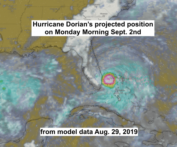
Hurricane Dorian
All eyes are now on the Bahamas and Florida this weekend as Hurricane Dorian moves across the Caribbean.
Click Map Below to play video of Dorian’s projected movement

Post by meteorologist Jim Woodmencey

