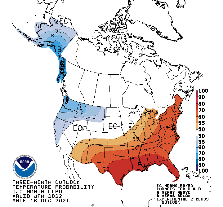
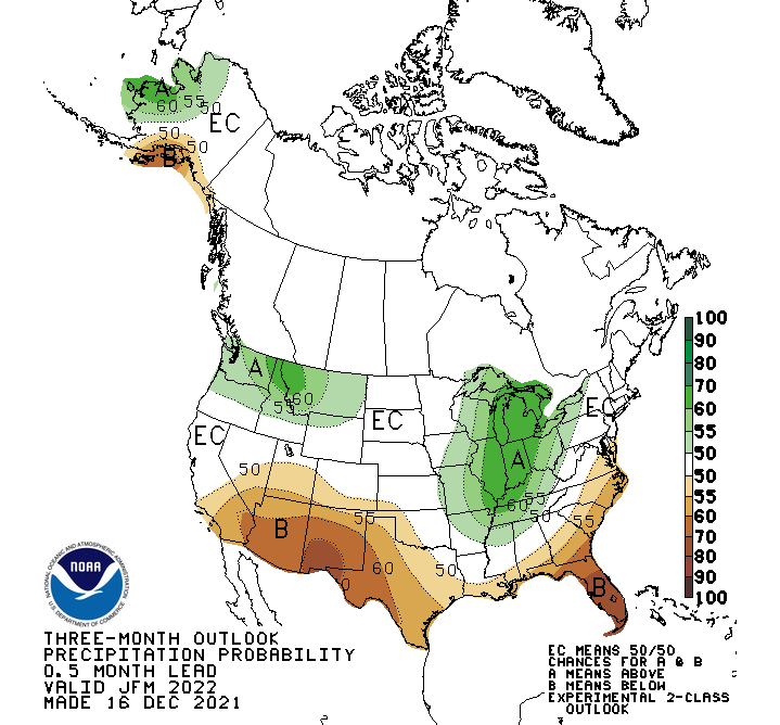
Here are the updated outlook maps for this winter, heading into 2022. These are from NOAA’s Climate Prediction Center and were updated in mid-December 2021 and are the most current outlooks for temperatures and precipitation for the period January through March 2022 for the USA.
Temperature Outlook: January-March 2022

Precipitation Outlook: January-March 2022

This update continues to show a typical La Niña pattern, with colder and wetter conditions across the Northwestern portion of the United States and drier and warmer across the Southwestern United States. In-between, across Northern California, Utah & Colorado are predicted to have are equal chances (50/50) of seeing above or below normal temperatures and precipitation.
The maps above are the “Two-Class” experimental outlooks, which are slightly different and a little less confusing than the older “Three-Class” outlooks. That is, they use a scale that starts at 50% or greater for above and below normal categories.
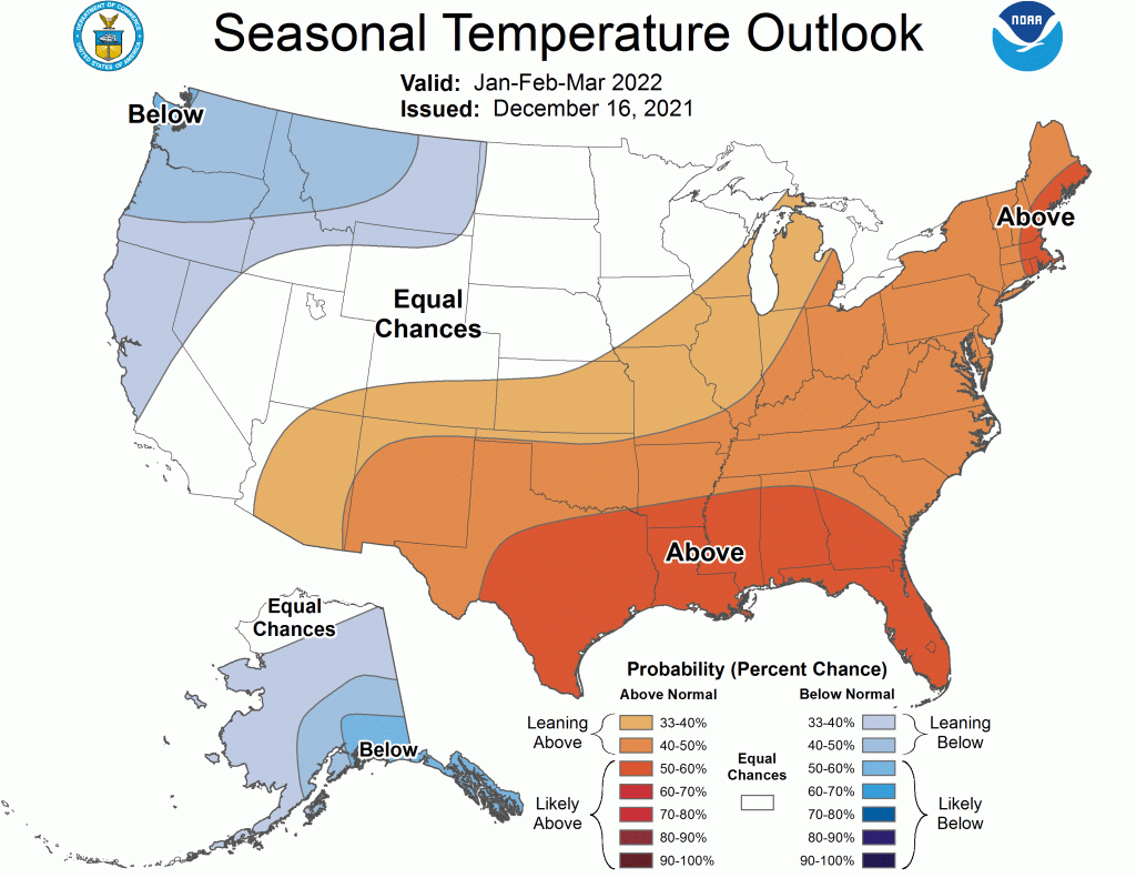
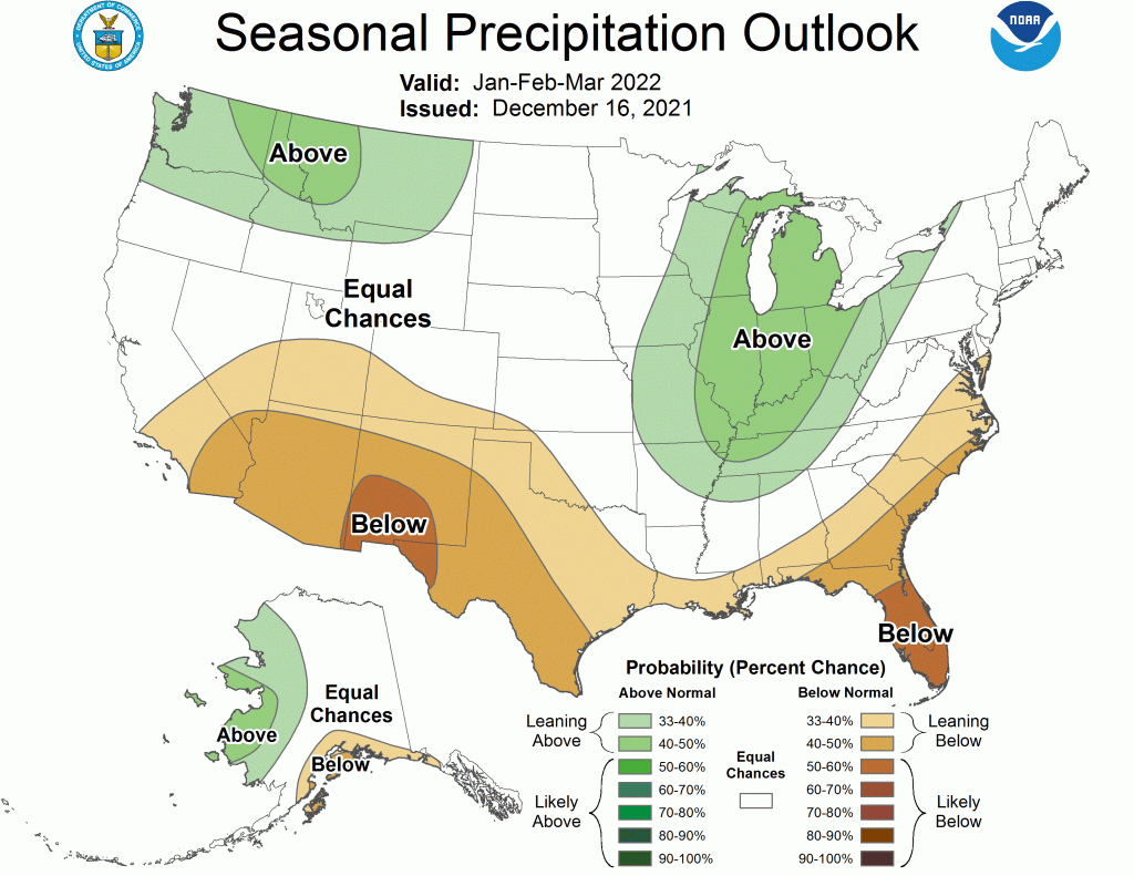
Three-Class Outlook from NOAA
The three-class outlooks use a more nebulous scale that starts at 33%. These are shown below for comparison.


My interpretation of these maps is that the tendencies towards below normal temperatures and above normal precipitation in the Northwestern United States are not that strong. The probability percentages listed on these maps are low, indicating they are only “leaning towards” these trends this winter. Same is true for the Southwestern United States.
Alaska and the Southeastern part of the country show the strongest probabilities for colder and warmer temperatures, respectively. Northwest Montana, Northern Idaho and the upper Midwest are the only areas that even approach a better than 50% probability of seeing above normal precipitation. Southern New Mexico and Florida are the only areas with greater than a 50% probability of being drier than normal the rest of this winter.
Take that for what you may and have a Happy New Year!
Post by meteorologist Jim Woodmencey on the Winter Solstice

