 |
| Meteorologist Jim Woodmencey |
A couple of summers ago I posted an explanation of the “Monsoon” on this blog, seemed appropriate to re-visit that this week.
We were getting some good surges of moisture from the Desert Southwest Monsoon this week, with rain and thunderstorms plaguing us, and some heavy downpors with late day thunderstorms the last two days (August 5 & 6, 2014).
If you happen to read my forecast discussions on the JH Forecast page of www.mountainweather.com or perhaps you listen to my forecast rap in the mornings on the radio (iMix 92.3 FM) you will frequently hear me mention “monsoon moisture”, during the summer months.
The term “monsoon” comes from the Arabic word mausim, which means “a season”. It refers to the large-scale wind flow that lasts for a whole season near the Indian Ocean and the Arabian Sea.
A “monsoon”, therefore, is simply a seasonal wind flow pattern. The Desert Southwest Monsoon that occurs in the United States is similar to the Asian Monsoon that affects India and the Himalayas during this same time of year, from July to early September.
The North American version of the monsoon kind of originates over the interior of Mexico, where very moist (i.e. humid), tropical air is converging over the land from the Pacific Ocean to the west and from the Gulf of Mexico to the east. That moisture is then drawn northward by southerly winds over the hot, dry deserts of the Southwest. This causes frequent strong thunderstorms over New Mexico and Arizona.
Often in July and August the monsoon will surge up into Utah and Colorado, causing thunderstorms over the deserts of southern Utah and western Colorado. Some of these thunderstorms create flash flooding situations in the canyon country of the Southwest.
A few times a summer that monsoon moisture will reach as far north as Northwest Wyoming and Southwest Montana, causing thunderstorms here, which are often some of the strongest of the summer season.
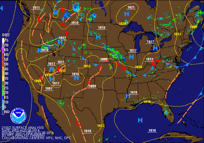
The typical weather pattern that sets up in July and August that will transport the monsoon moisture this far north is when a thermal Low pressure (dry low pressure caused by heating) develops over southeast California and western Arizona, at the same time High pressure develops over eastern Texas. Then when a Low pressure system or upper level Trof of Low pressure moves into the Northwest U.S., that helps draw that monsoon moisture northward. (See today’s weather map, which kind of shows that pattern, but not as well defined as some years).
 |
| Surface weather map Wed. August 6, 2014 |
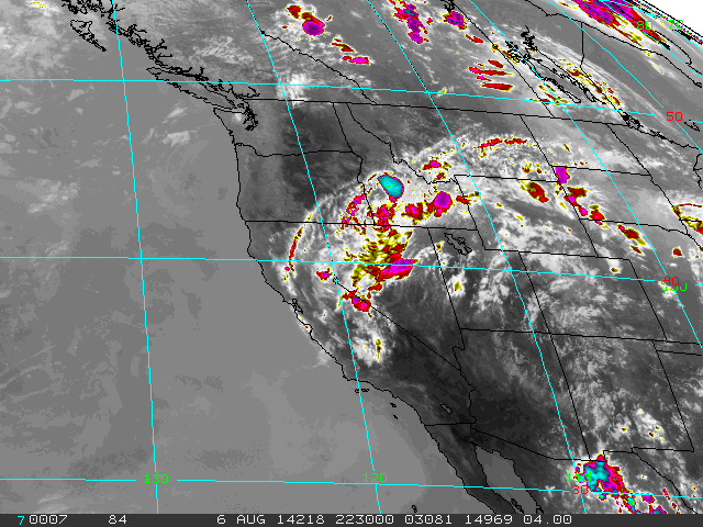
Monsoon Surge early August 2014
This round of monsoon moisture has been particularly WET, with flooding, landsldides, mudslides, etc. from California to Nevada, and Utah.
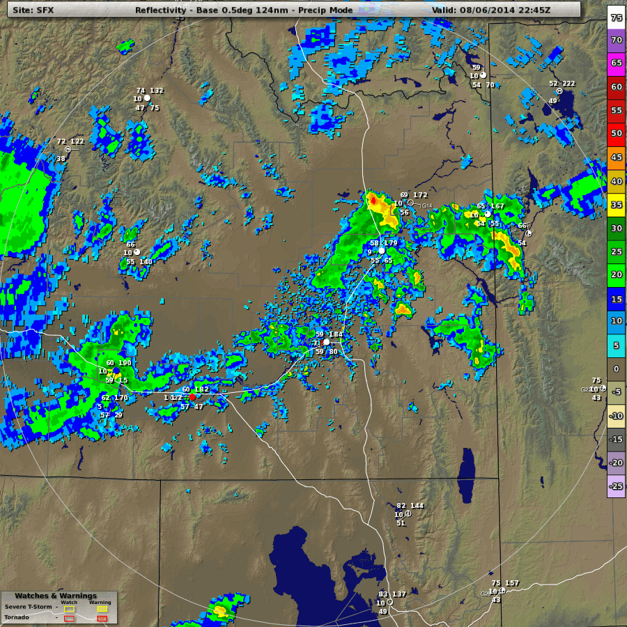
The downpours we had this afternoon (Wednesday August 6, 2014 ) in Jackson were aided by an upper level Trof of Low pressure that is moving over the Great Basin and making things even more unstable. Thunderstorms produced 0.40 inches of rain at my rain gauge in less than an hour! That’s more than we got the previous 24-hours.
Here are some weather maps from today…….Wednesday August 6, 2014.
 |
| Satellite showing extent of monsoon moisture from California to Wyoming |
 |
| Pocatello Radar @ 5pm Wednesday |
 |
| Snow King Lightning Detector screen shot @ 5pm Wed. |
Post by meteorologist Jim Woodmencey


