All posts by Jim Woodmencey
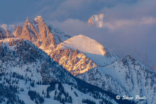
Alpenglow
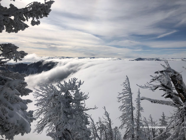
Mountain Stratus
Coldest November Ever in Jackson, WY
November 2022 was the coldest November on record in Jackson, Wyoming. Let me repeat that, to let it sink in, this November was the coldest November Jackson has ever experienced. And that’s saying something, because it happened without breaking a single daily temperature record in November.
The month of November was just consistently cold, with 12 days reporting morning low temperatures that were below zero Fahrenheit. The average low temperature for November 2022 was 6.2 degrees, which is a full 10 degrees colder than Jackson’s long-term average monthly low temperature in November.
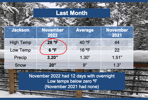
The average high temperature in November 2022 was 27.7 degrees, which is an amazing departure from the long-term average of 40 degrees in the month of November. That is a full 12 degrees colder than normal!
The coldest day of the month was on November 19th, 2022, with a low temp of 13 degrees below zero and a high temp of 11 degrees above zero.
Compared to one year ago, November, 2021 had no days with below zero temperatures and average high and low temperatures that were both several degrees above normal.
A Big Deal
The mean temperature for the month of November 2022 (the average of the average high and low temperatures for the month) was 17 degrees, which is 11 degrees below the long-term average mean temperature for the month of November.
All of this qualifies as the coldest November on record, going back through about 100 years of records. The previous coldest November in Jackson was 84 years ago, in 1938. The mean temperature that month was 18.8 degrees. No other month with complete records even comes close.
(Numbers in graphics are rounded up or down to whole numbers for simplicity).
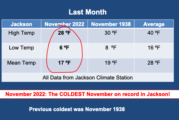
This might very well be one of the largest differences between the long-term average temperatures and new record temperatures that I have seen in my 30 years of compiling and studying the weather stats here in Jackson.
Period of Record Stats
Long-term records refer to the entire period of record for a climate station. Jackson’s records date back to the early 1900’s. However, in analyzing monthly temperature averages like this, you have to throw out the years with incomplete records. Any month with more than 5 days of missing data is disqualified from this analysis.
The chart below shows all the years with complete data to calculate a monthly mean temperature in November, about 86 years that met the criteria.
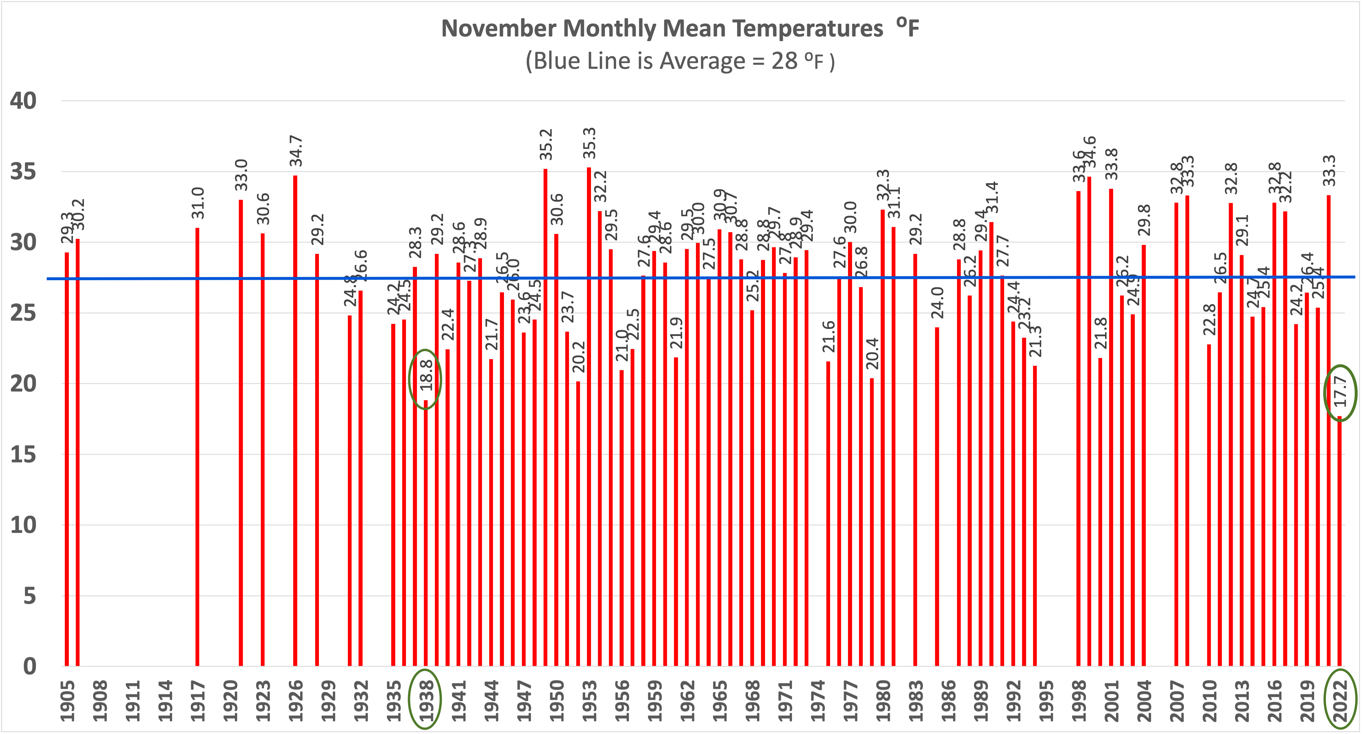
By the way, if you think November was somehow a one-off, it was not. In recent times, October of 2019 was the coldest October on record, and 2019 was also the Coldest Year on Record in Jackson.
All data is from the Jackson Climate Station, which is located on North Cache Street in Jackson, WY.
Posted by meteorologist Jim Woodmencey of MountainWeather.com
December 5th, 2022
Dusk in the Tetons
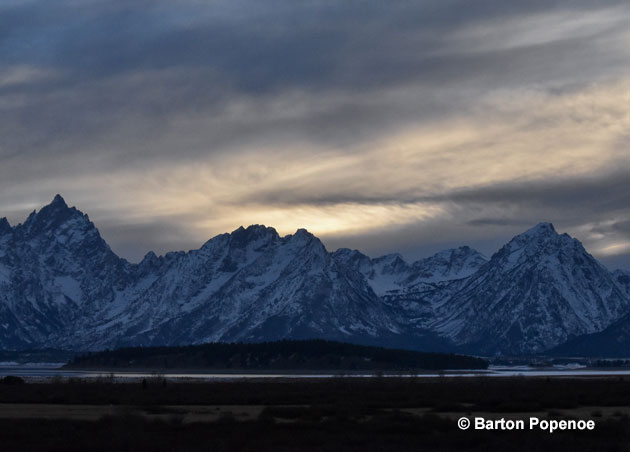
Tetons in Autumn
A Long Indian Summer this October
According to the Glossary of Weather and Climate, Indian Summer is defined as:
A time interval in mid or late autumn, of unseasonably warm weather, generally clear skies, sunny but hazy days, and cool nights. At least one killing frost and preferably a substantial period of normally cool weather must precede this warm spell in order for it to be considered a true “Indian Summer”. It does not occur every year; and in some years two or three Indian Summers may occur.
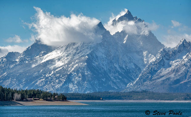
The weather in Jackson Hole and across much of the West and Rockies during the first 3 weeks of October 2022, fit that bill, for the most part. At least most everyone I’ve spoken with has referred to it as “Indian Summer” weather. Which has been welcomed by most and loathed by a few. There are those among us who might prefer to see Mother Nature bring on the snow by mid-October. I am not one of them.
What Caused it?
This year’s spectacular October weather was courtesy of a big, warm ridge of high-pressure that developed over the western United States. That ridge has remained sandwiched in-between two large and cold troughs of low-pressure.
One of those low-pressure centers has been parked over the eastern United States causing colder than normal temperatures, cloudy skies, and rain. Some areas around the Great Lakes have also seen snow. The other low-pressure area is to the west of us, in the Pacific. That low has been circulating around out there bringing rain and snow to south-central and southeastern Alaska.
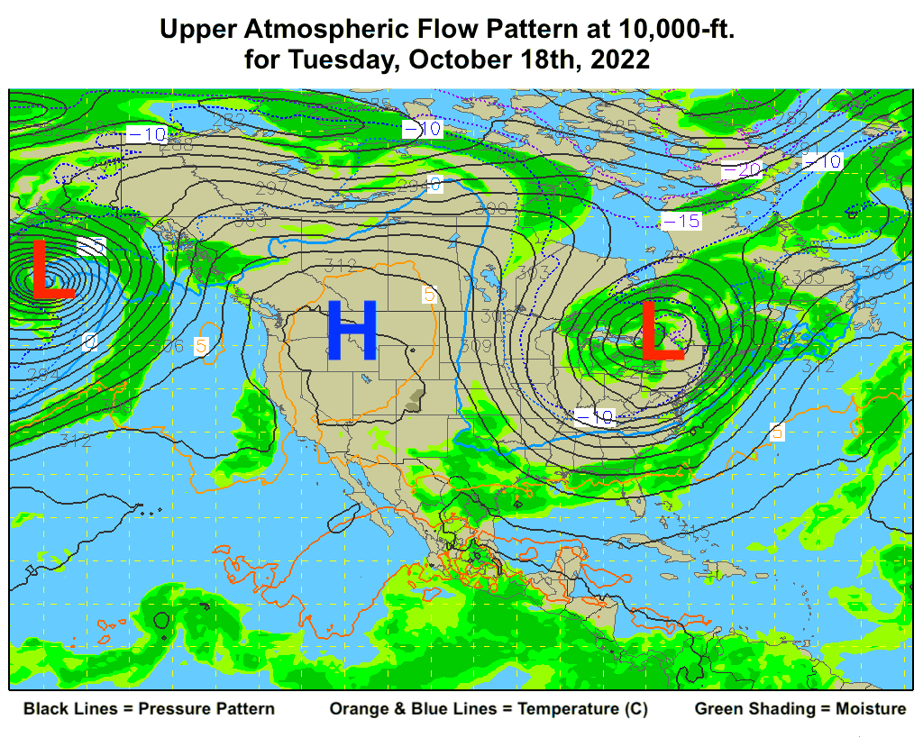
This is a classic blocking pattern in the atmosphere, one that occurs periodically. It is nothing unusual and it looks like it will be breaking down very soon.
Short Memories
I have always maintained that we have very short memories when it comes to the weather. For instance, could you tell me what last October was like in Jackson, WY? Or perhaps the last three Octobers? Were they warm and dry, cold and wet?
To be honest, if I don’t go back and look it up, I can’t always instantly recall what the weather was doing here from one year to the next. Unless there was something I did that was memorable, like backpacking in the Wind River Range at 11,000-feet in mid-October, about 10 years ago? Or skiing on Teton Pass by Halloween, in whatever year that was? See what I mean.
To refresh our memories, here is a rundown of what the weather was like in Jackson the last few Octobers, as they were all quite different.
October of 2021
Last October began with high temperatures in the mid to upper 60’s during the first week, with two days in there with highs of 71-degrees. Through the first two weeks of this October, we had a spate of days with highs in the mid 60’s, the warmest high temperature in town through mid-month was 68-degrees on October 9th, 2022.
The second week of October 2021, temperatures cooled, and we got some rain. At the end of that second week, Jackson had several days with high temperatures only in the 30’s and 40’s, with a little bit of snow in town, near a half-inch, on October 13th, 2021.
Overnight low temperatures in the first half of October 2021 got down into the teens several times. This October, the coldest morning was 21 degrees on October 10th, 2022.
October of 2020
Two years ago, October 2020 also started out warm and dry, much warmer than this October, with high temperatures over 70 degrees in town every day for the first 10 days of the month! The warmest day was October 7th, 2020, with a high temperature of 75 degrees in town. Another October that had a great Indian Summer.
By the end of the second week of October, however, it snowed about 2 inches in town. At the very end of the month there was record breaking cold, with a high temperature of only 18 degrees and a low temperature of minus 9 degrees on October 26th, 2020. Those are the coldest high and low temperatures ever recorded in Jackson during the month of October. That was just two Octobers ago, mind you.
October of 2019
Three years ago, October 2019 started out cooler than normal, with our first measurable snow in town on October 1st. High temperatures fluctuated wildly throughout the first two weeks or so of the month, ranging from 30 degrees to 66 degrees in town. Overnight low temperatures had already dipped into the single digits by October 11th, 2019, with a low of 8 degrees.
October 2019 established new record low temperatures for the month of October, with a high temperature of 20 degrees and a low of minus 6 degrees on October 29th, 2019. Both of those monthly records were broken the following year, in October 2020, as noted above.
Overall, October 2019 remains the coldest October ever recorded in Jackson, for both average high and average low temperatures. No Indian Summer here that October.
The Ups and Downs
Whether we get an Indian Summer or not, depends on the weather pattern. Sometimes we are under a high-pressure ridge, sometimes we are under a low-pressure trough. When either of those features persists overhead, we either get long stretches of warm and dry, or cold and wet weather. Sometimes we are in-between or the weather pattern is more transitory, and thus variable.
The weather pattern this October kept high pressure parked over us and allowed a long stretch of Indian Summer weather. Personally, I’ve enjoyed it, winter is already long enough, without adding autumn to that schedule.
NOTE: To learn more about the origins and history of the term Indian Summer, check out this article published on the Old Farmer’s Almanac website. Or this one from the Farmers’ Almanac.
Jim is the chief meteorologist at mountainweather.com and has provided a weather forecast for Jackson Hole and the Teton Range for the over 30 years
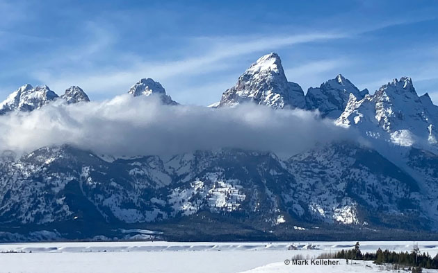
Autumn in the Tetons
Winter 2022-23 Outlook
We are now past the Autumnal Equinox and for the remainder of the fall season the days will be getting shorter and the sun a little lower in the sky as we roll closer to the winter season. That should come as no surprise, as this happens every year around this time.
The other thing that happens every year around this time is people start asking me, “What kind of winter are we going to have?” The more diehard skiers actually start asking before the end of August. So, every year, I feel obligated to take a look at all of the various outlooks for the coming winter season.
This year I’ll include both the Farmer’s Almanac and the Old Farmer’s Almanac takes on what to expect of this coming winter’s weather, along with the long-range outlook from NOAA’s Climate Prediction Center and a few other less conventional forecast sources.
Old Farmer’s Almanac
The Old Farmer’s Almanac is the yellow-jacketed paperback that has been around for over 230 years and is a treasure trove of all kinds of weather, astronomy, farming and gardening trivia. It is the consummate bathroom book.
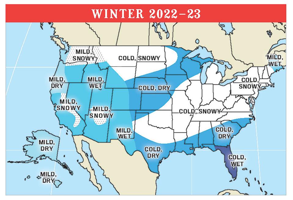
This year’s edition just came out and what their weather map shows for western Wyoming and the Jackson Hole area for this winter is, “Mild and Wet” conditions. I suppose you could interpret that to mean above normal snowfall, but not too cold. I know the diehard skiers will read it that way.
The Farmer’s Almanac
The Farmer’s Almanac is the other almanac, the orange covered one, it’s not quite as old as its competitor, but is still chock-full of all kinds of weird folksy information and would also compliment that library within reach of your toilet.
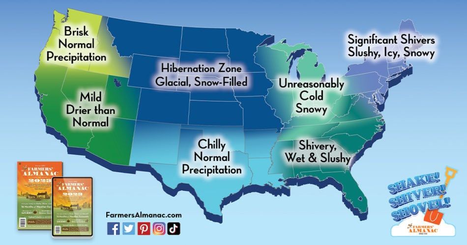
Their outlooks are usually written with a more cryptic flair, leaving the reader to wonder what exactly it means? This year their weather map shows all of Wyoming underneath an area that says, “Hibernation Zone. Glacial, Snow-filled”. Wow! Glacial and snow-filled can only mean one thing, tons of powder skiing for us this winter.
NOAA and ENSO Outlook
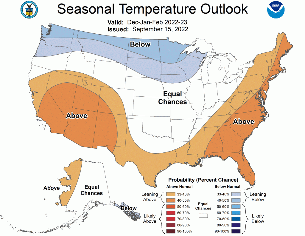
The latest forecast maps from NOAA’s Climate Prediction Center, issued in mid-September, are not showing anything out of the ordinary over this part of Wyoming. For December, January and February, they are predicting colder than normal temperatures to the north of us, from Washington State to Minnesota, and warmer than normal temperatures over the Southwestern United States. Wyoming sits in-between and essentially ends up with a 50/50 chance of being above or below normal for temperatures this winter.
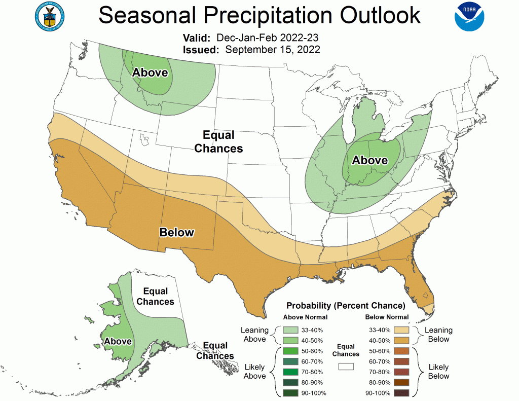
NOAA’s outlook also predicts above normal precipitation over northern Idaho and western Montana, with Northwestern Wyoming right along the margin of that above normal zone. Any diehard skier would certainly call that close enough to say we’re likely going to have a snowier than normal winter this year.
As far as the El Nino-La Nina situation is concerned, NOAA is predicting that the current La Nina conditions that we have been in since last winter will continue this fall, with a little less confidence that it will continue through the entire winter.
That is usually good news for us, as the storm track favors the Northern tier of the U.S. in a La Niña. However, every La Nina year is a little different, some have been huge for snowfall here in Jackson Hole and others, like last winter, have ended up more mediocre. Although, we did have a big December and a big April for snowfall last winter, but very little in the middle.
Wooly Worms, Raspberries and Pinecones
There are a few other indicators that I am going to consider this year. One is the wooly worms. It is said that when they are all black, with no stripes, it portends a long winter. Most of the wooly worms I have seen out on the trails this past month were all very black.
The other indicator I learned of this year is the bumper crop of raspberries, like at my neighbor Dave’s house. He’s been told by some Wyoming old timers that a really good crop of raspberries is an indicator of big snow in the coming winter.
The third indicator is an abundant crop of pinecones. Where I live in the trees on Snow King, the local squirrels have been very busy tossing down copious amounts of pinecones on my roof and my yard for the last few weeks. They must know something I don’t. I figure if they are vigorously storing up that many nuts, they must be expecting a huge winter. Call me nuts, but I’m banking on the squirrels and raspberries to predict the weather for this coming winter.
Jim is the chief meteorologist at mountainweather.com and has provided a weather forecast for Jackson Hole and the Teton Range for the over 30 years
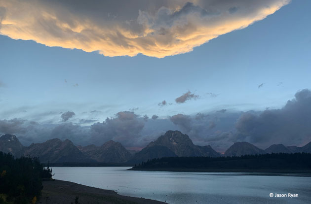
September Storm Clouds
