All posts by Jim Woodmencey
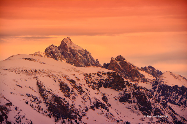
Tetons from the Tram
Snow Update for MLK Weekend
Friday Jan. 18, 2019
The Low-pressure center that brought good snowfall across the mountain of the Western U.S the last couple of days has moved east into the Plains States. A Ridge of High pressure is now building along the West Coast today, and that Ridge will move east across the Rockies over the Martin Luther King Holiday Weekend.
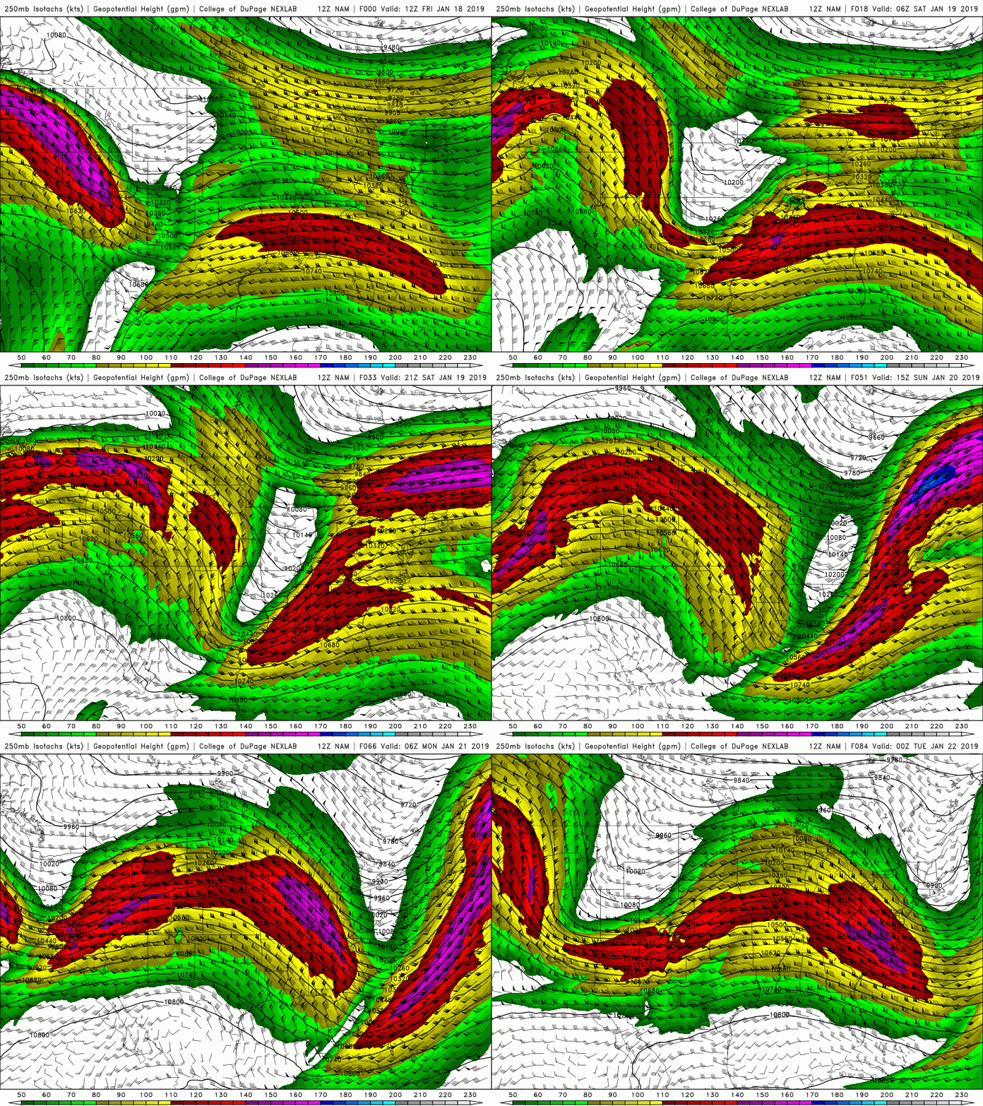
This will result in a Northwesterly flow over the northern Rockies Saturday. Then transitioning to a Southwesterly flow Sunday, ahead of a small upper level disturbance. See Jet Stream (@35,000-ft.) loop below for Friday thru Monday.
Saturday-Monday, Jan. 19-21, 2019
Temperatures in the Rockies will warm aloft as that Ridge builds inland Saturday. Some rain mixing with snow at lower elevations. Best snowfall accumulations look to be Saturday night thru Sunday, for Sierras, then the Ridge shifts east of the Rockies and colder air returns Sunday-Monday, with best snowfall for Rockies.
SNOWFALL FORECAST MAPS
The Sierra Nevada mountains & the Rockies get some snow from the NW flow & then the WSW flow ahead of the next disturbance moving in from the Pacific. Models vary in the total amounts for different geographic areas…….
For Example: In the Teton Range of Western Wyoming the NAM shows 10 to 15 inches of accumulation thru the MLK Weekend, whereas, the WRF show much more, 20 to 24 inches.
This flip-flops for the Sierra Nevada Range in California, where the WRF shows 10 to 15 in, the NAM has much more, >24 in.!!
Go figure? Which model will be correct? (See maps below to compare).
By the way, the storm that is exiting the Rockies today will be bringing snow to the mountains of New England later this MLK Weekend.
Forecast Snowfall Accumulation from NAM model below:
Forecast Snowfall Accumulation from CAIC-WRF model below:

Have a great weekend!
Post by meteorologist Jim Woodmencey
New Snow Ahead of MLK Weekend
A Low pressure center on the West Coast has been spinning moisture over both Northern & Southern California the last couple of days. Now it is rotating some of that moisture inland in a stronger Southwesterly flow aloft.
That Low is helping to break down the High pressure that has been parked over the interior of the Western U.S. for the last week.
As this Low-pressure moves inland today (Wednesday) & Thursday it will weaken and be followed by a Ridge of High pressure that will build over the far Western U.S. by later Friday & for Saturday.
SNOWFALL POTENTIAL
The Sierra Nevada Mountains will benefit the most from this storm the next two days. Maps below are from two different computer models, showing 3 to 5 feet of snow accumulation between Wednesday morning and Friday morning (Jan. 16 to 18).
- Sierra Nevada Range will accumulate 3 to 5+ feet.
- Wasatch mountains of Utah could see 1 to 2 feet.
- Teton Range looks to pick up 8 to 10 inches.
- San Juan mountains in Colorado 8 to 12 inches possible.

Another snowfall forecast model below, from the CAIC in Colorado shows a similar picture, for roughly the same time period, Wednesday to Friday morning. This one might have a little more in certain places than than the NAM.
Good timing for Skiing & Boarding just ahead of the Martin Luther King Weekend!

Post by meteorologist Jim Woodmencey
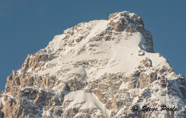
Grand East Face
Snow on the Way
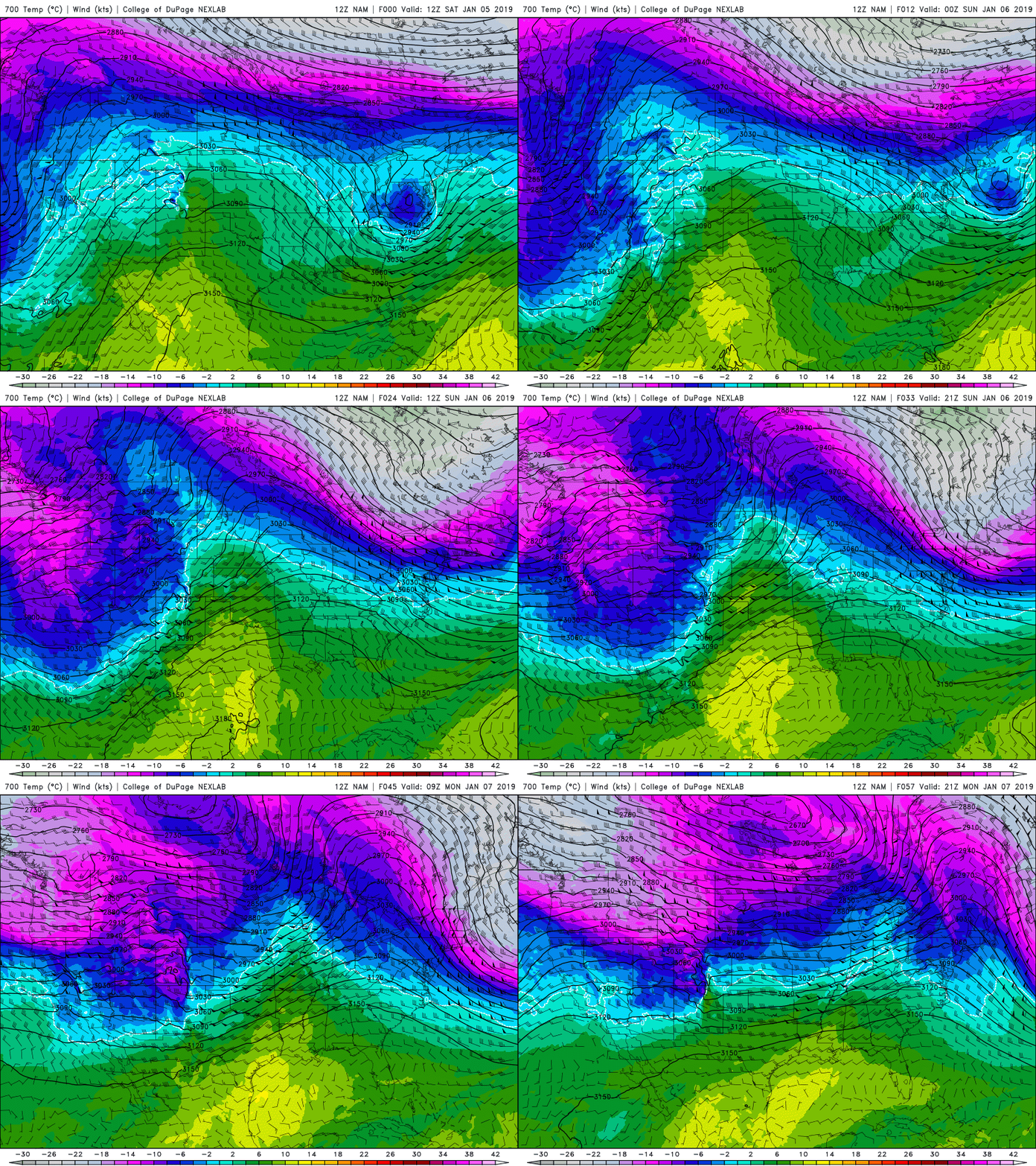
The big, strong Ridge of High pressure that has been parked over the interior of the Western United States this first week of the New Year will finally be breaking down today and that will open the door to some Pacific moisture to move inland Sunday & Monday, January 6 & 7, 2019.
Sunday: Warmer Southwest Flow
A moderately strong and moist Southwesterly flow will extend from the West Coast to the Rockies Saturday night into Sunday morning. That flow is out ahead of a weakening Trof of Low pressure that is currently sitting along the West Coast.
That SW flow will be warming temps at all elevations, as valley inversions, like we have seen in Jackson Hole all week, will finally be broken. Snowfall beginning Saturday night and into Monday afternoon across the Northern Rockies.
Snow accumulation from Saturday night Sunday afternoon on map below.

Monday: Cooler Westerly Flow
A stronger Westerly flow will bring a little more moisture inland late Sunday into early Monday. That will bring another shot of Pacific moisture, along with cooler temps aloft….like single digits at 10,000-ft. on Monday.
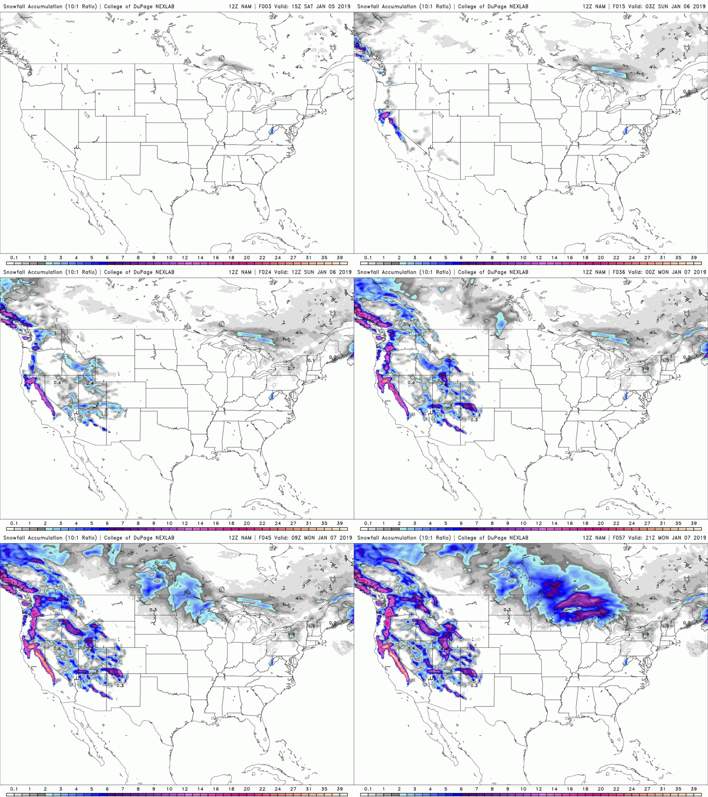
Total snow accumulation, Saturday night thru Monday afternoon on map below.

USA Snow Accumulation Saturday thru Monday, in video loop below.
Bottom Line is:
The Sierra Nevada range will do best with this weather pattern this weekend, with 2 feet or more at the higher elevations. The Cascades of WA & OR will also do pretty good.
The Tetons & Wind River Ranges in WY , the Wasatch & Bear River ranges in UT & the San Juan mountains of SW CO do good too, with a foot or more of new snow accumulation by end of day Monday.
Back to a weaker, Ridge of high pressure on Tuesday, the way it looks right now.
Post by meteorologist Jim Woodmencey
Happy New Year 2019
Cold New Year’s 2019
A good portion of the Rockies and Plains States will be waking up to start the New year with some very cold temperatures. A cold Trof of Low pressure at all elevations in the atmosphere has moved south from Canada in a Northerly flow.
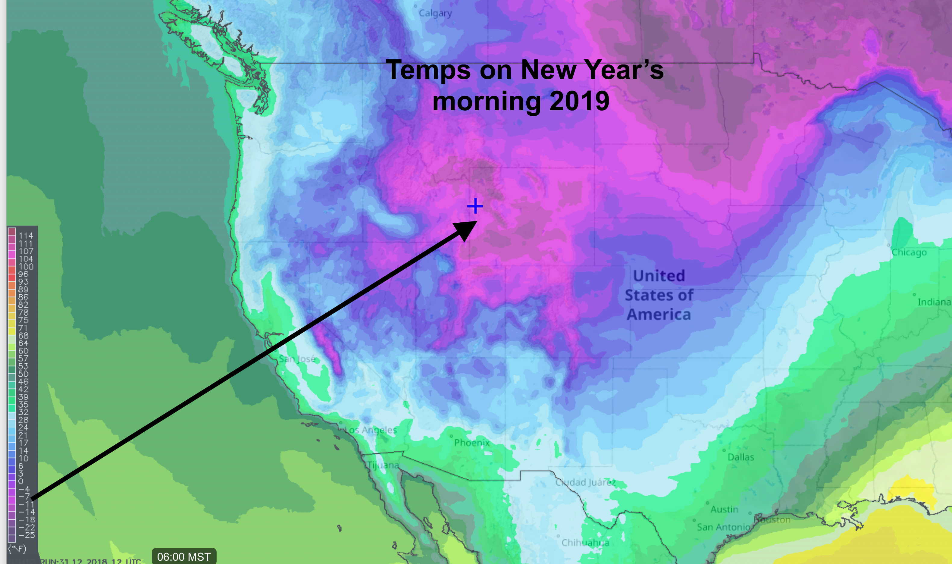
Below is a temperature forecast map for 6:00 AM (Mountain Time) on New Year’s Day. Pink & purple colors represents temps below zero Fahrenheit.
Jackson Hole, WY looks to drop into the teens below zero. Some areas may reach 20-below. BUT! That will depend on cloud cover and wind. Some clouds &/or some wind overnight will keep temps warmer than forecast. No wind & no clouds and it will reach 20-below.
Cold Up High
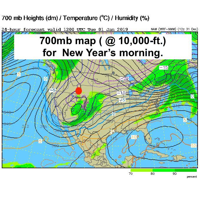
Temps are not any warmer up at elevation this last day of 2018, but thankfully they will be warming up the first few days of 2019, with temperature inversions setting up.
It will get warmer up high as it gets colder down low. So, if you are skiing Jackson Hole this New Year’s week, “go up to warm up!”
Forecast map below for the 700mb level in the atmosphere, or near the 10,000-ft. Elevation. Temps in Celsius, 15 below zero C equals +5 degrees F. So, it could be 20 degrees warmer up high on New Year’s Day in the mountains. (Jackon Hole marked with red dot).
Cold & Windy Last Day of 2018
What Jackson Hole woke up to this morning was very cold air and strong northerly winds. Winds in the valley were over 20 mph and winds on top of the tram were over 40 mph. That made for some brutal wind chills, in the minus 30-degree range at times up at 10,000-ft in the Tetons.
Below are the Temperature and Wind graphs for the past 24-hours (Sunday AM to Monday AM) and a wind chill chart for reference. (Click to expand and print!)
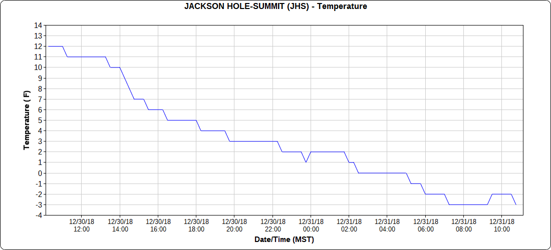
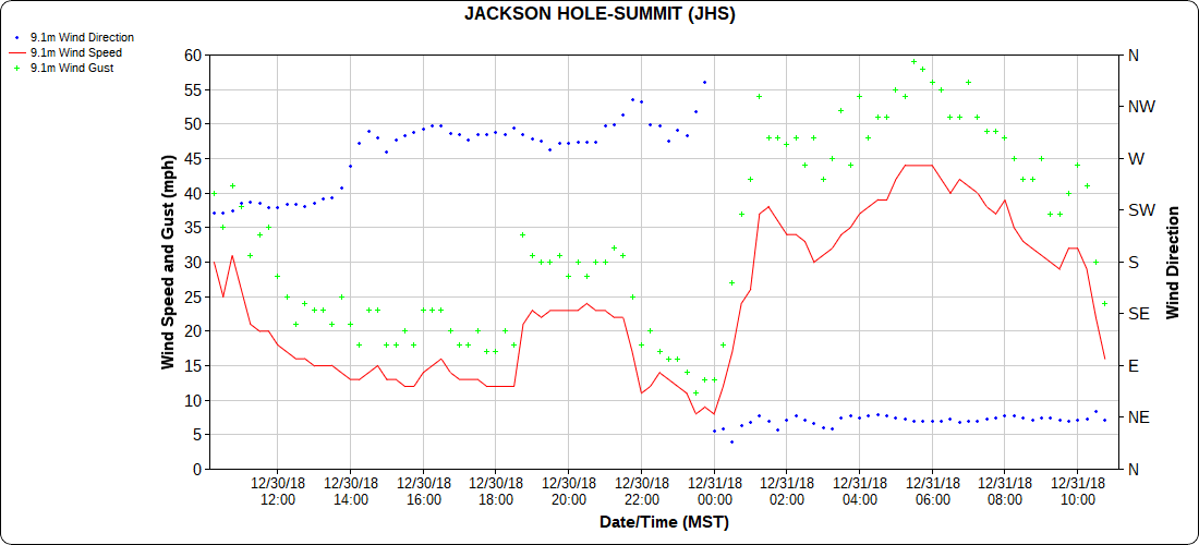
Around 6:00 AM Monday morning the temp at the top of the tram was -2F, with a wind speed of 44 mph, making it feel like it was 33 below zero!
Happy New Year! Stay Warm!
Post by meteorologist Jim Woodmencey
Christmas 2018
The Solstice, Santa & Snow
Welcome to Winter! The Solstice was December 21st, 2018, at 3:23 pm MST. One cool feature of this year’s Solstice is a full moon, or almost full. The peak of that full moon is on Saturday, Dec. 22nd.
Scroll down to see updated snow accumulation forecasts for Christmas.
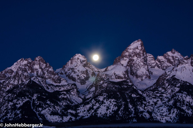
Snow on Ground
This year on the Winter Solstice there is pretty good snow-cover across the Norther tier of the United States, especially in the northern & central Rockies, the Cascades of Washington and in British Columbia’s mountains.
Snow depths December 21st, 2018 below

Compare that to last year on the same day….
Snow depths December 21st, 2017 below

Last year on the Solstice there was more snow at lower elevations across the northern tier of the U.S. But similar depths in the mountains.
New Snow for Santa
Below are a couple of different computer model forecasts of total new snow accumulation expected between Saturday and Christmas Day, December 22nd through December 25th.
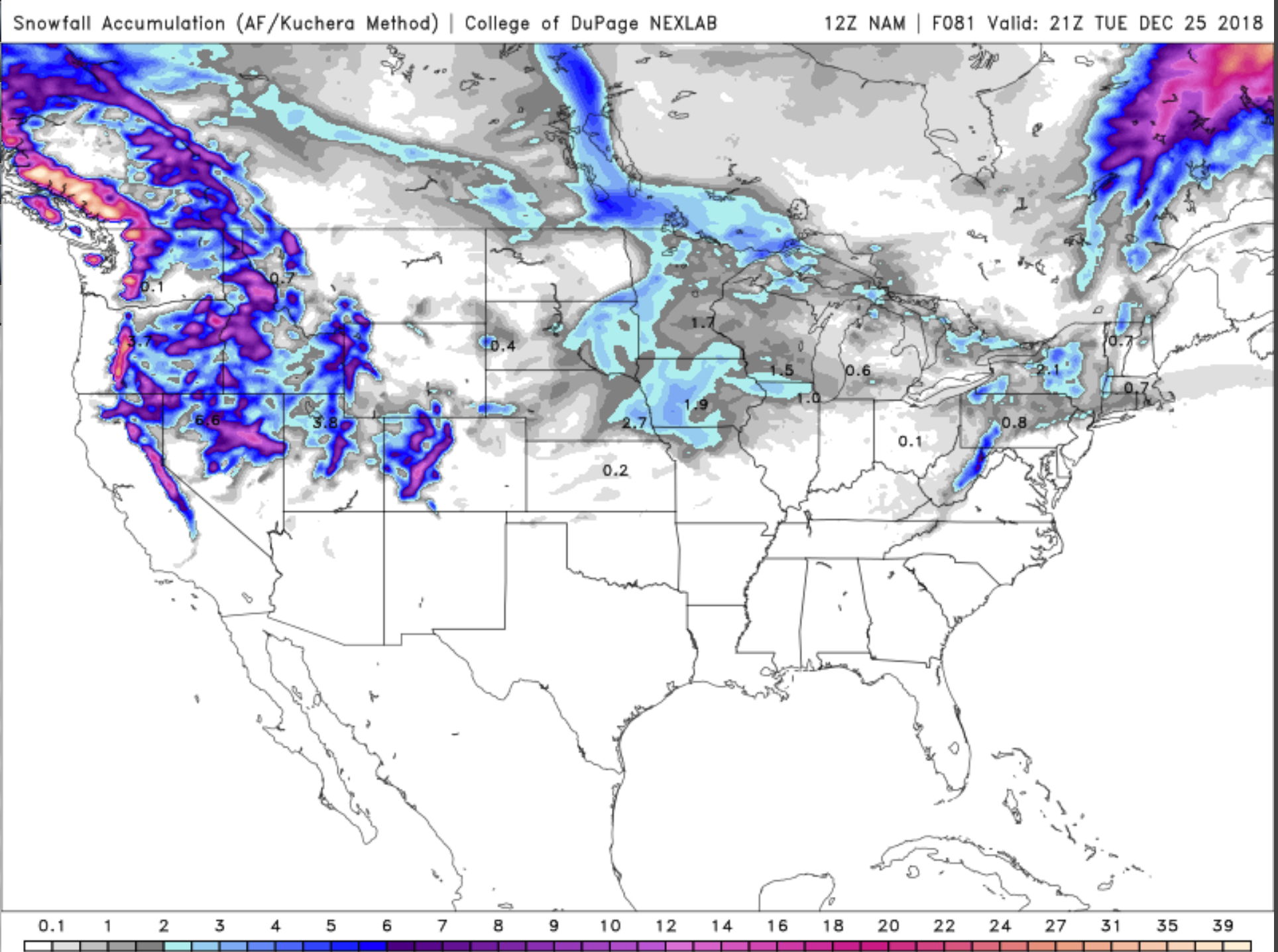
Looks like coastal British Columbia’s mountains & parts of the higher Cascades could get up to two feet of new snow through Christmas Day.
Northern Idaho, western Wyoming, northern Utah and parts of Colorado’s Rockies should get at least 6 inches and some locations will see a foot or so of fresh snow. Most of which arrives Sunday & Monday.
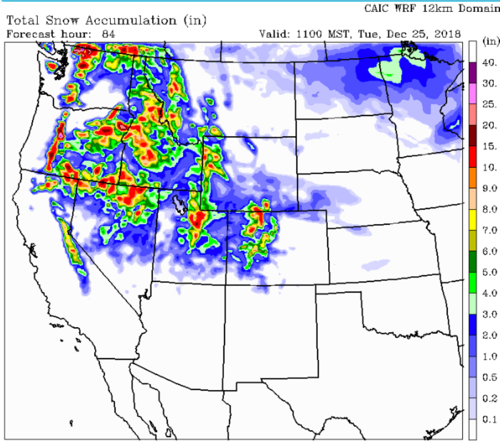
This new snow is brought to us by a relatively strong Westerly flow that will be streaming across the northern tier of the United States this weekend.
Low pressure systems embedded in that flow, along with cold air pushing southward over the northern half of the U.S. will help assure a little more white stuff on the ground in the above mentioned areas, for Christmas Day.
Merry Christmas Everyone!
Post by meteorologist Jim Woodmencey


