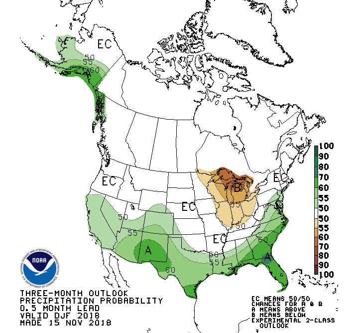
The Climate Prediction Center, CPC for short, since late this past summer has maintained a pattern of keeping the Pacific Northwest and northern Rockies under the category of “Equal Chances”, for having above normal or below normal precipitation during the winter months os 2018-19.
That covers the three-month period, December through February. This same trend of non-committal, 50/50 forecasts of precipitation probability, continues right through April of 2019. Precip map below….
Temperatures from December through the end of winter and into the spring season are forecast to be above normal, across the entire western United States. Temp map below…
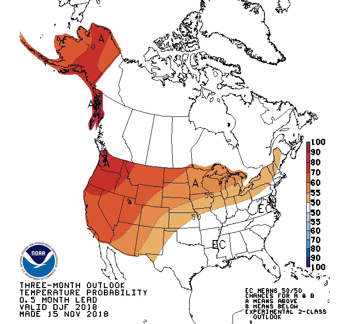
From all of that, I guess we should expect temperatures to be milder this winter. Whether we will see more or less snow than average, however, is still a coin-flip.
El Nino Update
The latest update from the CPC done on December 10th, 2018 about the status of the predicted coming of an El Nino for this winter shows that they are still 80-percent confident that an El Nino will form and will continue through the Northern Hemisphere winter 2018-19.
The Equatorial Pacific Ocean has most recently been stuck in Neutral, or “No-Nino” conditions, since this past February.
Review: El Nino is one phase of ENSO, the El Nino Southern Oscillation. This oscillation reflects the changes in sea-surface temperatures in the Equatorial Pacific. During an El Nino phase, ocean temperatures are warmer than normal. During a La Nina phase, ocean temperatures are cooler than normal.
When temperatures are normal, it is called, “Neutral”, or No Nino.
Typically, an El Nino brings warm and dry conditions across the Pacific Northwest and Northern Rockies. At the same time, it brings wetter and cooler winters to California and the southwestern United States.
La Nina winters are usually more favorable for bringing bigger snow winters to the Pacific Northwest and northern Rockies, including the Teton Mountains.
Read more about the current state of ENSO here: NWS ENSO page
El-La-No for Jackson Hole
I did an analysis of winter season snowfall versus the state of the ENSO each season and found a few interesting facts from the last 40+ years. I used the Rendezvous Bowl data on the upper mountain at the Jackson Hole Mountain Resort, from the winter of 1974-75 through last winter 2017-18.
Graph of data below:
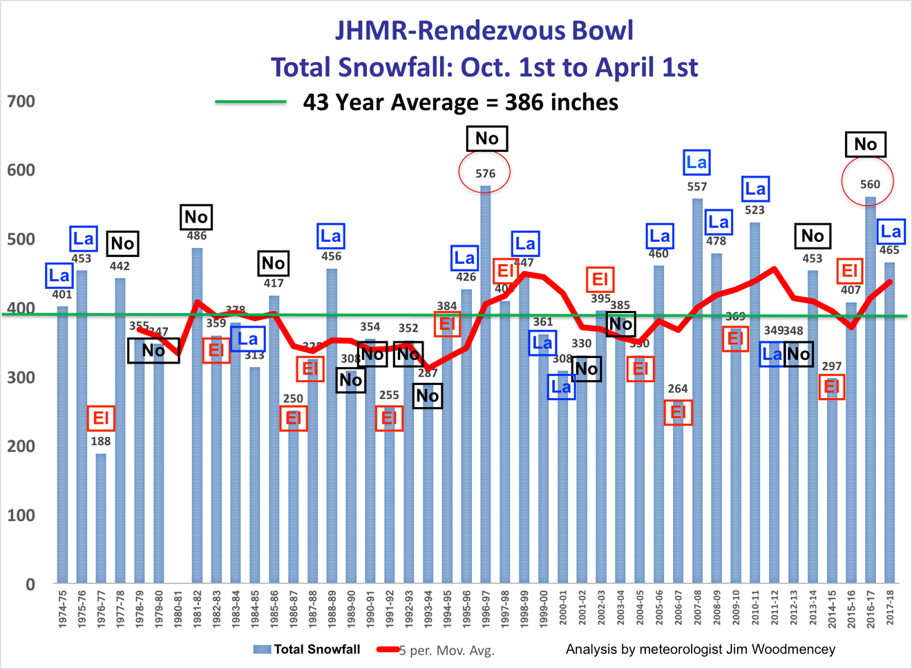
Summary of JHMR Data:
1) There were 15 La Nina winters, 10 of those had above average snowfall.
2) There were 14 No Nino winters, 6 of those had above average snowfall. Including the two biggest winters ever, 1996-97 & 2016-17).
3) There were 13 El Nino winters, only 3 of those had above average snowfall.
Could this El Nino that is developing be number four? We can only hope.
Farmer’s Predictions Look Better
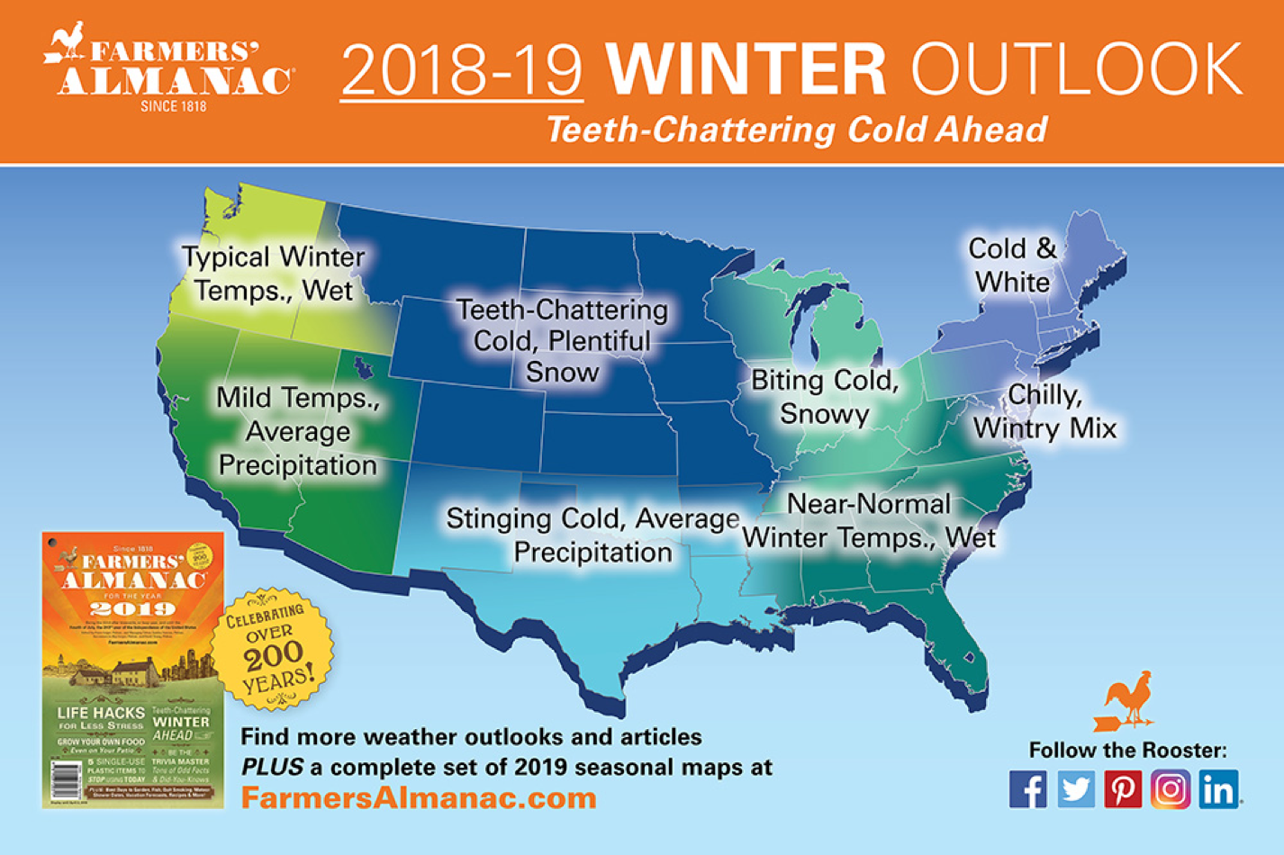
Both the 2019 Farmer’s Almanac and the 2019 Old Farmer’s Almanac show forecast maps that paint a better-looking picture for a snowier winter in these here parts.
The Farmer’s Almanac keeps the Pacific Northwest wet and shows “teeth-chattering cold” with “plentiful” snow over Wyoming. Their map below…..
The Old Farmer’s Almanac has Idaho & Wyoming sitting under “mild and snowy” conditions for the winter. Their map below….
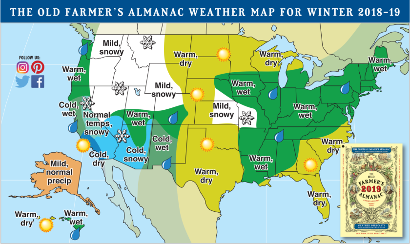
That sounds more like what we are looking for, don’t you think?
Posted by meteorologist Jim Woodmencey
Some of the content used in this post first appeared in the Jackson Hole News & Guide on December 5th, 2018.