One of the snowiest February’s ever for many parts of the Western United States is not quite over. More snow on the way for the Pacific Northwest & Northern Rockies. Looks like the Sierra Nevada & Colorado miss out on this weekend’s snow for the most part
The Set-Up
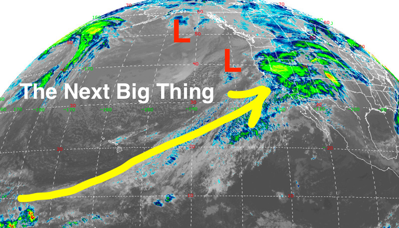
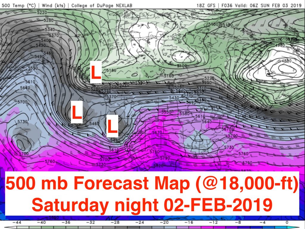
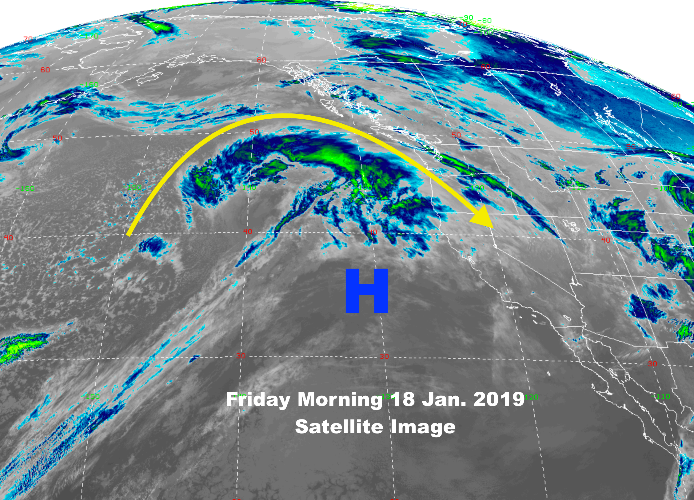
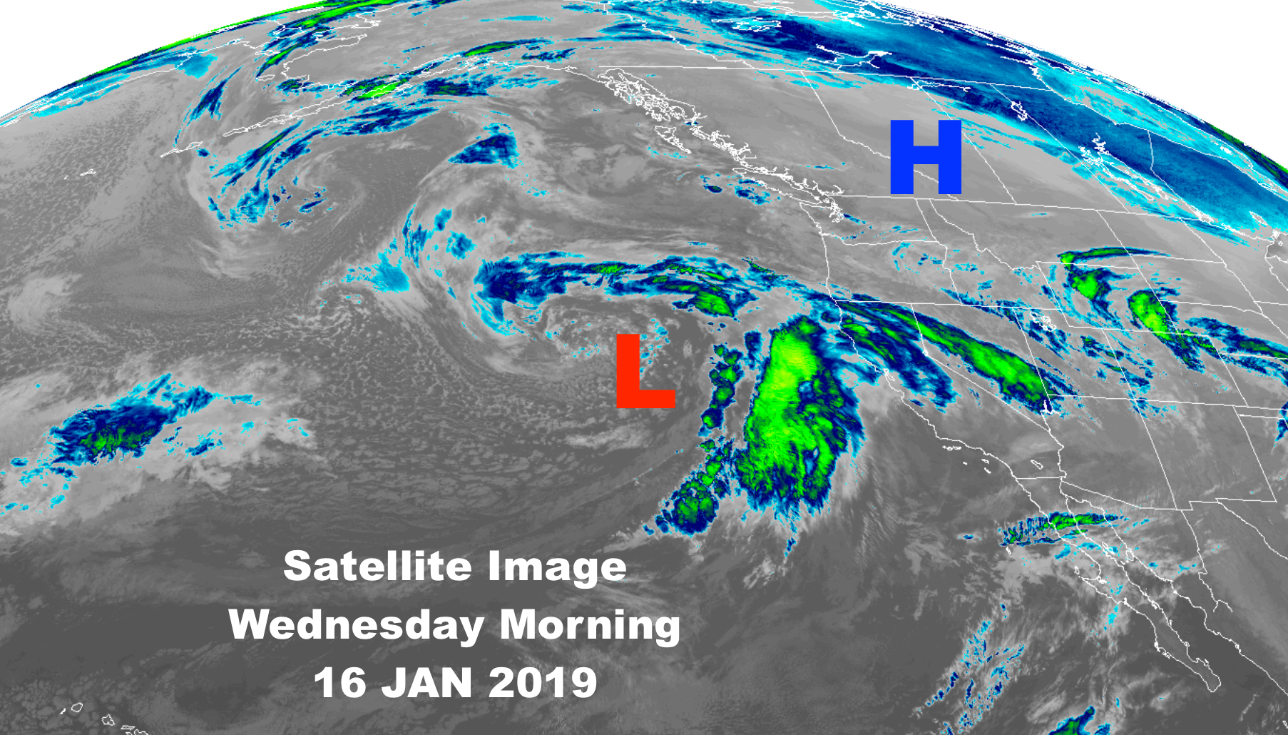
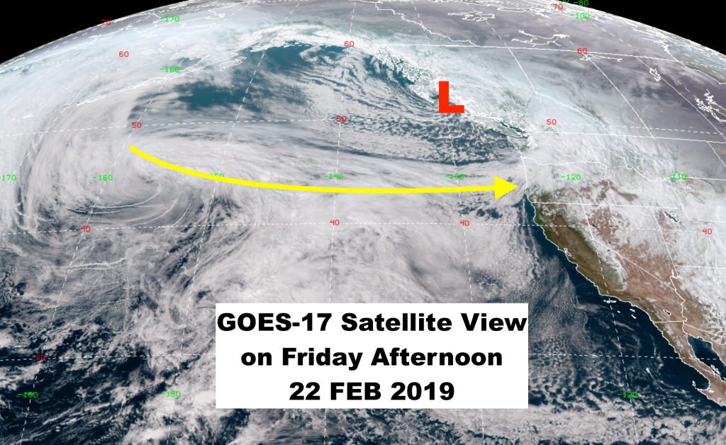
A cold Low-pressure center on the British Columbia Coast will drop further south & direct a relatively long stream of Pacific moisture inland across Washington, Oregon, Idaho & Western Wyoming beginning Saturday. That moisture is moving along in a very fast, Westerly flow aloft. Expect big snow & big wind with this go-around.
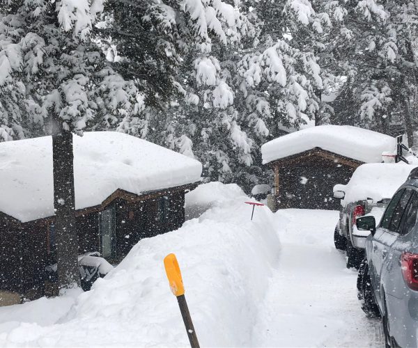
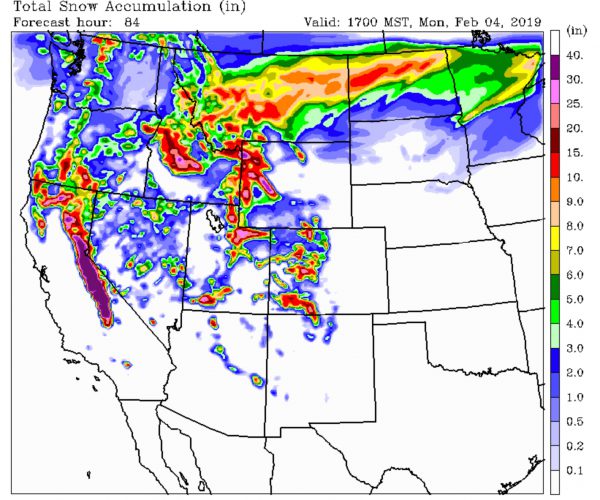
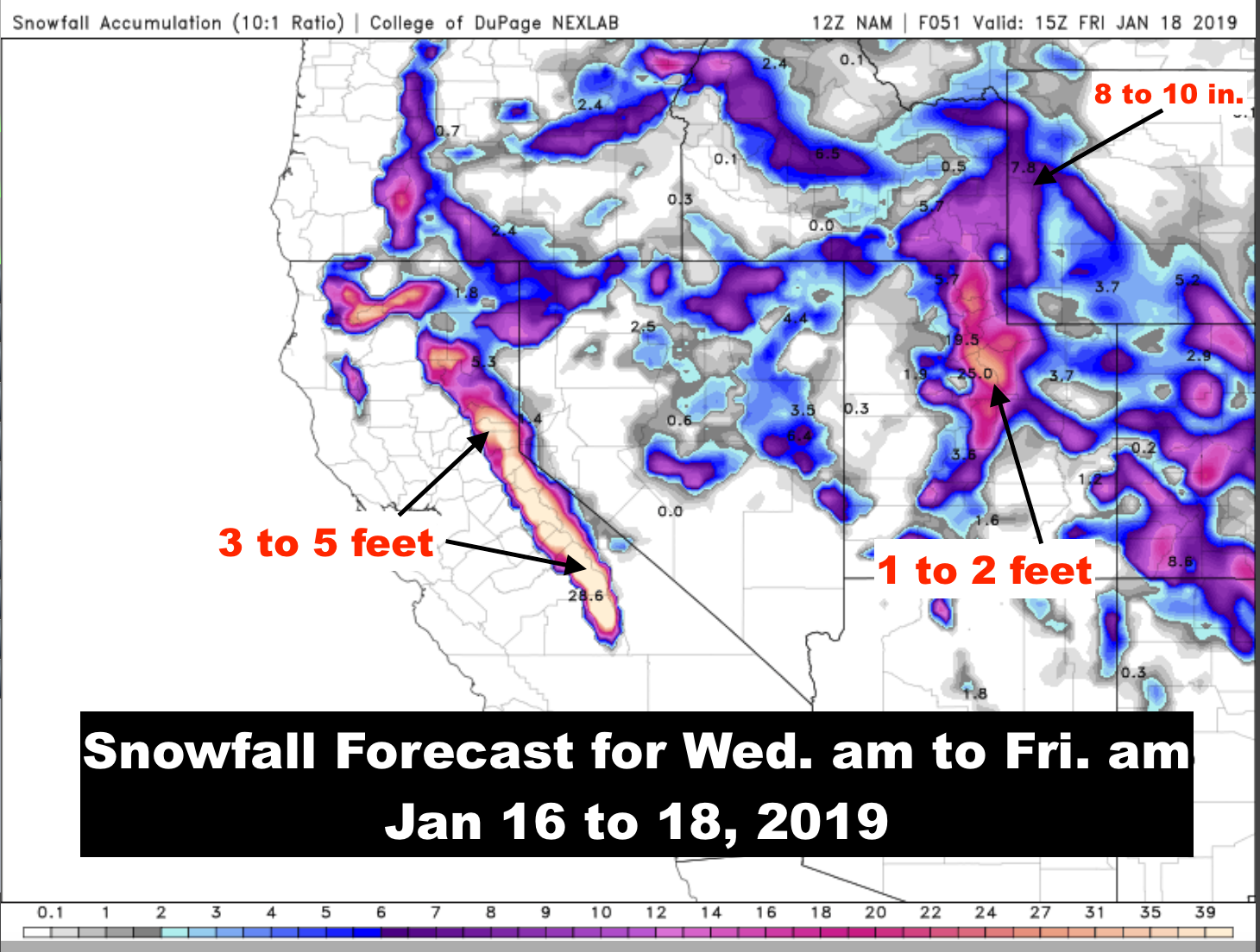
That hose-down will continue through Monday night and possibly into Tuesday of next week. Adding to the already epic snow totals experienced this month, from the day it started on February 2nd.
Makes me thing that the Groundhog is either really pissed-off or he has been reincarnated as Ullr the Snow-god!
Big Snow & Big Wind
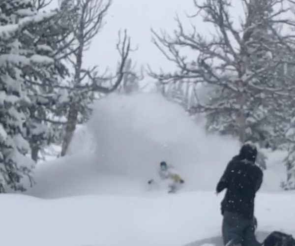
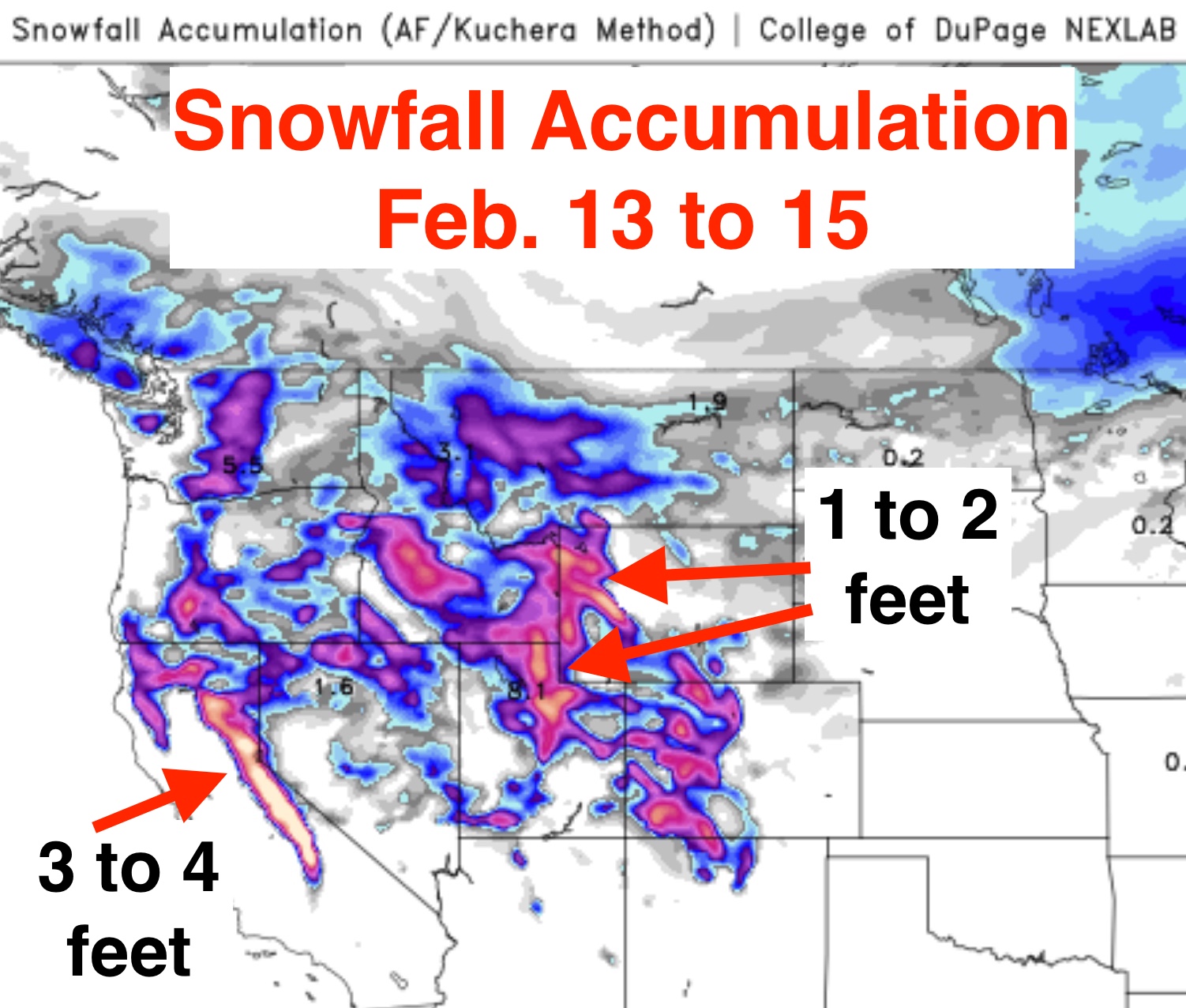
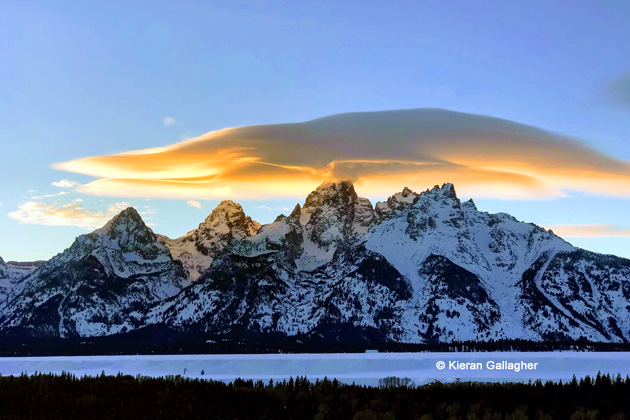
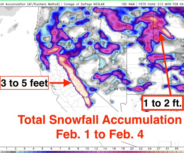
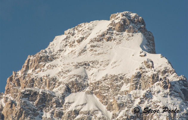
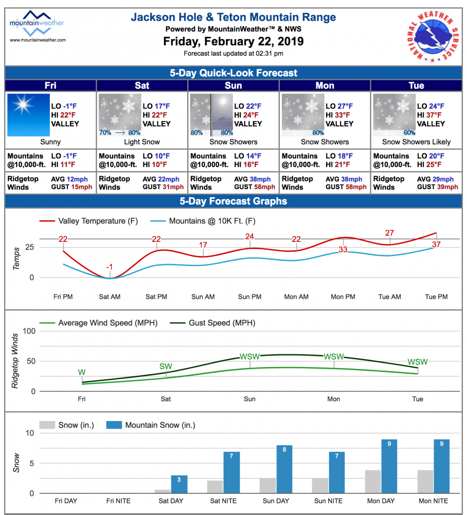
The Cascades of Washington & Oregon, 4 or 5 feet in paces not out of the question. Idaho’s western mountains, and the western mountains of Wyoming,including the Tetons, Yellowstone Park & the Wind River Range accumulate another 3 feet at the higher elevations.
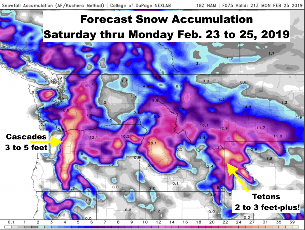
Valley locations will also see good accumulations, so keep the shovels & ibuprofen handy.
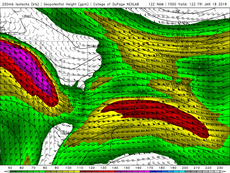
A strong Westerly flow aloft develops Saturday, causing a lot of blowing & drifting and likely raising the avalanche hazard once again.
Temps will warm thru Sunday & Monday, as well. But rain to elevations @6,000-ft.
The Blue Bars on the graph of the Jackson Hole Forecast tell the tale….that really adds up the next few days…..
Posted by meteorologist Jim Woodmencey