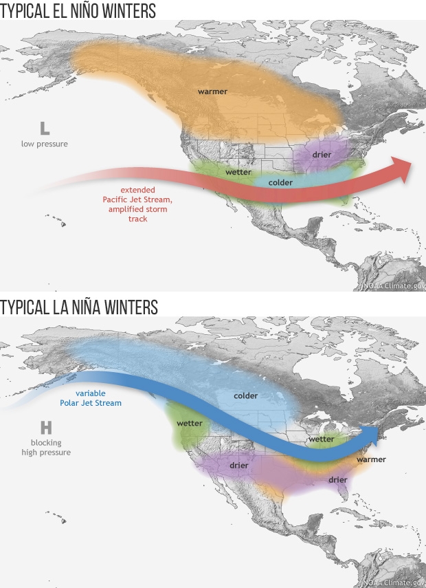
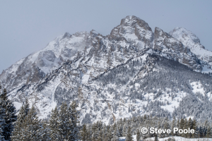
It was a slow start to the Winter of 2023-24, but a big February and record March snowfall saved our winter. The winter ended with above average snowfall in both the Jackson Hole valley and up in the mountains.
Think back to how grim the winter was looking around here all through December and into the first week of January. The Town of Jackson only had one inch of settled snow on the ground on New Year’s Day. The average snow depth that time of year in town is around 8 inches.

The mountains were also looking skinny, snowpack-wise. The upper elevations at the Jackson Hole Mountain Resort only had 36 inches of snow on the ground on January 1st, 2024. The average depth there on that date is 58 inches. The base of the mountain only had 5 inches of snow on the ground on New Year’s Day, and the historical average there is 22 inches.
 Click here to view video…skiing on Teton Pass 29DEC2023
Mid-January brought some hope and relief, but it was February and March that piled it on. Read on for a complete review of the winter’s snowfall numbers and how they compared to years past and the averages.
Town Snow
Winter began almost bone dry. Very little snow fell in November and December’s total snowfall in town was less than 6 inches, compared to an average snowfall in December of 17 inches.
A couple of good storms mid-January gave winter a much-needed shot in the arm, ending the month with 21.9 inches of snowfall, which is just above the average January snowfall in town of 19 inches.
February 2024 added another 34.6 inches of snowfall in town, making that the third snowiest February on record in Jackson. Only February of 2019 with 55 inches and February of 1999 with 44 inches had more than this past February.
March came in like a lion and went out like a lion. On March 1st to 2nd, 2024, Jackson broke a 24-hour snowfall record, with 17 inches of accumulation in town. That is the most snow ever recorded in one day during the month of March in Jackson. The previous record was 14 inches on March 25th, 1907.
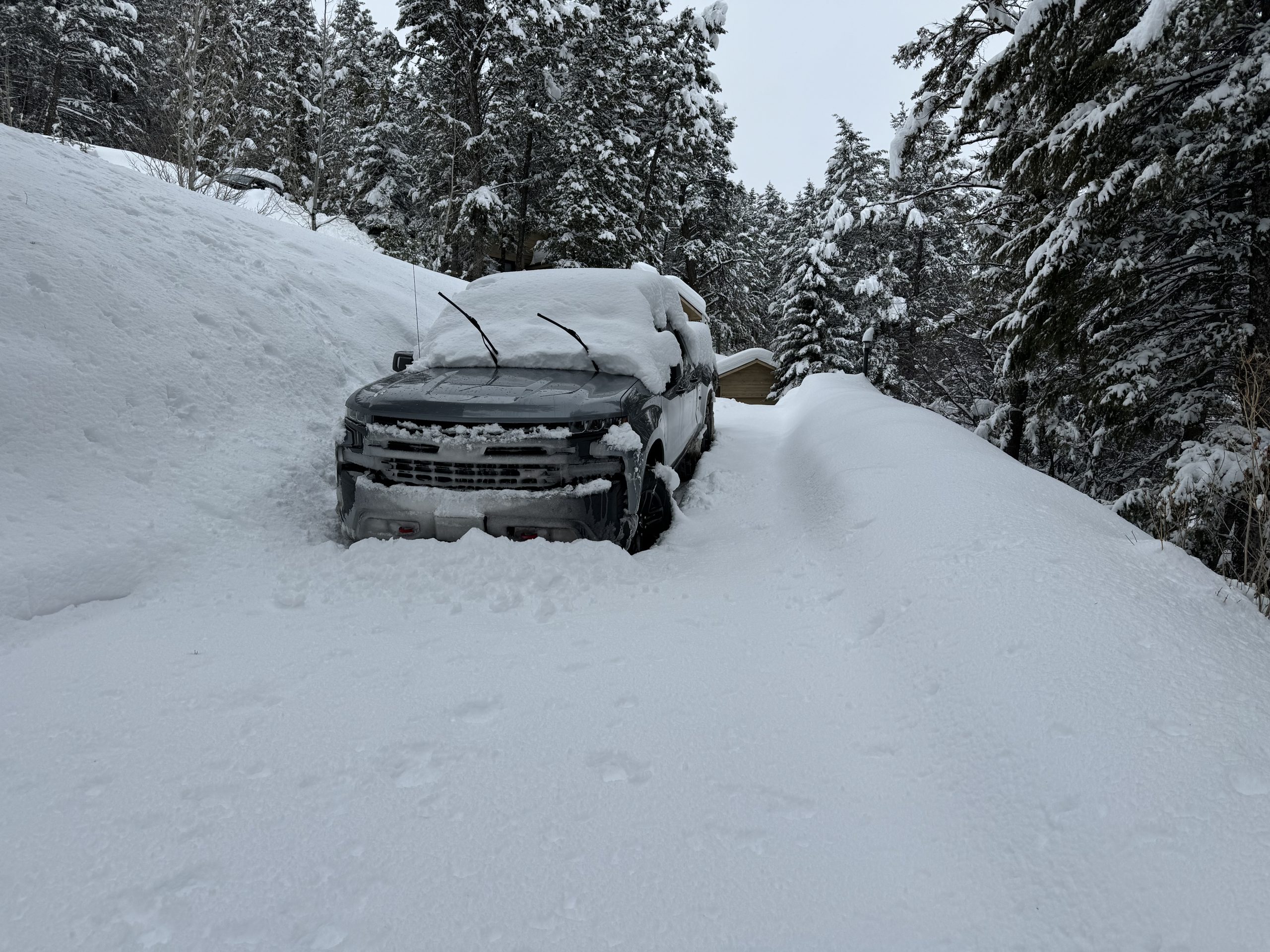
March continued to roar, ultimately breaking the monthly snowfall record with a total of 33.9 inches. That beat out the old record for March snowfall of 32.8 inches, set back in 1938.
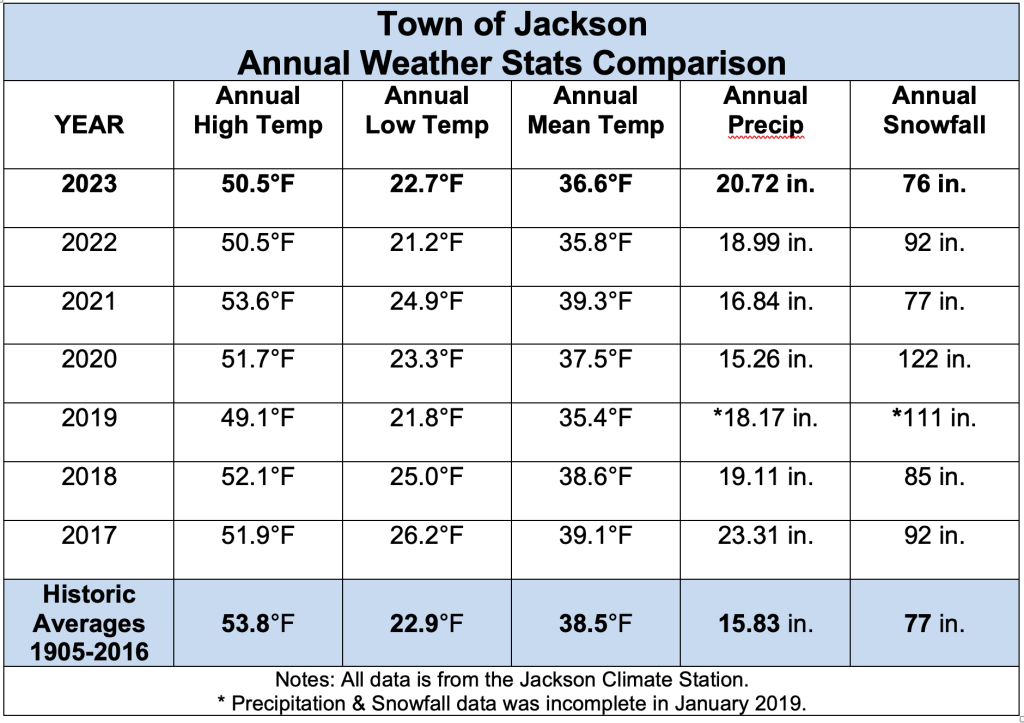
Total Snowfall for the four months of winter, December through March in Jackson was just over 96 inches, 96.2 inches to be exact. That is 157-percent of the average winter snowfall in Jackson of 61 inches. Surprisingly, this winter also bested last winter’s December through March snowfall total in town of 83 inches.
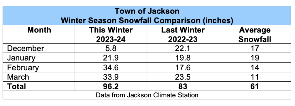
Jackson also measured 7.11 inches of water in that snow. That is 132-percent of the average December through March precipitation amount of 5.39 inches. This winter was also wetter than last winter, the December through March precipitation in 2022-23 was 6.50 inches.
Mountain Snow
Snowfall in the mountains this winter during the “ski-season”, from December 1st to April 1st, ended up above average. The Rendezvous Bowl study plot at around the 9,600-foot elevation at the Jackson Hole Mountain Resort tallied 360 inches for December 2023 through March 2024. That is more than the long-term average of 312 inches for that time period, but nowhere close to the record-breaking snowfall total of the previous winter, which had 443 inches from December through March 2022-23.
It was February and March this year that picked up the slack. February 2024 had 131 inches of snowfall at the Rendezvous Bowl site, making it the 5th snowiest February there in 49 seasons. March of 2024 had 99 inches of snowfall, tying it with March of 2018 for the 7th snowiest March on record.
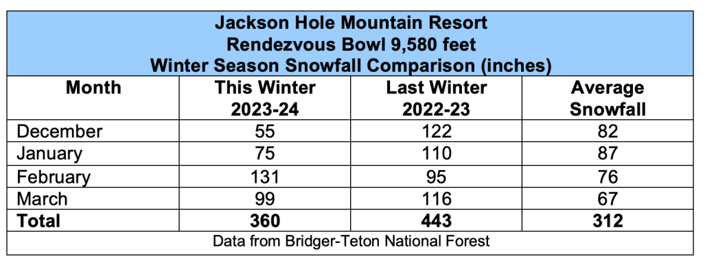
JHMR also broke their one-day snowfall record on March 1st to 2nd, 2024 at Rendezvous Bowl, with 31 inches of snow recorded at Rendezvous Bowl in a 24-hour period. That blew away the old one-day snowfall record of 26 inches from December 23rd to 24th, 2008.
Snow Summary
Last winter had an earlier start, with snow beginning in November, and basically never letting up, with every winter month seeing above average snowfall. This winter had a later start, with well below average snowfall in November, December and into January. Then in February and March of this year winter finally kicked in, outperforming the previous year.
February and March of 2024 had a combined total snowfall just shy of 69 inches in the Town of Jackson, compared to February and March of 2023 which had 41 inches combined. Both years were well above the long-term average total snowfall for the two months of 25 inches.
In the mountains, Rendezvous Bowl recorded a total of 230 inches of snow this February and March, whereas the combined total snowfall for February and March of 2023 was 211 inches. The average snowfall at that location for February and March combined is 140 inches.
Although it came later, overall, the winter of 2023-24 still ended up a snowier than normal winter, both in town and in the mountains.
Jim is the chief meteorologist at mountainweather.com and has forecast the weather in Jackson Hole for over 30 years.
Note: This post originally appeared in the Jackson Hole news & Guide April 17th, 2024 issue.